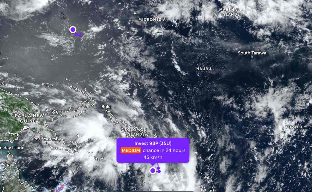
According to storm news, the latest low pressure from the Joint Typhoon Warning Center (JTWC), two low pressures are operating in the Pacific Ocean.
The low pressure bearing the symbol Invest 98P (Tropical Low 35U) is operating in the South of the Solomon Islands, in the South Pacific. The strongest wind near the center of the low pressure reaches 45 km/h.
JTWC forecasts that the low pressure has a moderate possibility of developing into a tropical depression or storm in the next 24 hours.
Meanwhile, a low pressure with the symbol Invest 98W has just formed in the western Pacific region. The strongest wind near the center of the low pressure reaches 30 km/h. The low pressure is unlikely to develop strongly into a tropical depression in the next 24 hours.
On the other hand, Super Typhoon Narelle - which has weakened into a tropical storm - is hovering over mainland Northern Australia. As of this morning, March 22, the storm's center is about 533 km southeast of Darwin, Australia. In the past 6 hours, the storm has moved southwest at a speed of 22 km/h. Wind speed near the storm's center reached 140 km/h.
It is forecast that Hurricane Narelle will continue to move southwest, along the northern edge of a strong subtropical high pressure range in central Australia in the next 3 days. The storm will move into the Indian Ocean, pass near Adele Island in about 60 hours, and then pass through North Broome in the next 3 days.
It is forecast that Hurricane Narelle will weaken into a tropical depression when it is in Joseph Bonaparte Bay near the border of Northern/Western Territory, according to the latest recommendation from the Australian Bureau of Meteorology (BoM).
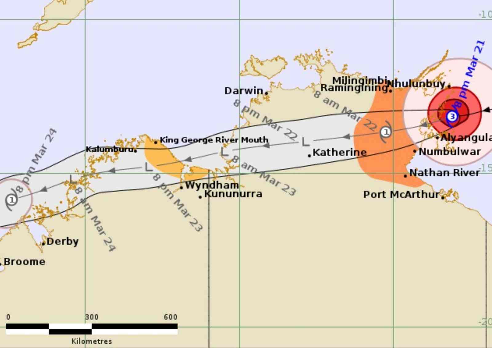
Before moving towards Western Australia, Hurricane Narelle is expected to affect coastal areas between Birany Birany and Numbulwar. Severe weather warnings have been issued about heavy, locally intense rainfall, likely to cause dangerous flash floods and life-threatening between Birany Birany and Numbulwar, including Groote Eylandt, and spreading deep inland towards Bulman.
The meteorological agency warned that as the storm moves westward, strong gusts could reach 90 km/h between the King George River estuary and the border area. The risk of flash floods due to heavy rain may occur in northern Kimberley on Monday. Many flood warnings have been issued across both states.
People and tourists planning to travel to Northern Australia and the area where the storm passes should pay attention to weather forecasts. Check flight schedules and follow local instructions to ensure safety.


