The tropical depression (symbol 34U) over the Coral Sea, in the South Pacific region, is being closely monitored and is likely to strengthen into Typhoon Narelle tonight.
The tropical depression is currently about 1,300 km northeast of Cairns, Australia, moving slowly westward.
According to the latest storm forecast from the Australian Bureau of Meteorology (BOM), Hurricane Narelle may enter the Northern Queensland area from this weekend.
When approaching the mainland, the storm can cause strong gusts of 120 km/h, even up to 155 km/h in some areas, accompanied by heavy rain commonly 200-300 mm.
The current scenario shows that the storm may reach level 1 today, March 17, increasing to level 2-3 before making landfall on Cape York Peninsula, expected from March 19-20 (there is still a time error). After making landfall, the system may weaken and then continue to move to Carpentaria Bay.
Meanwhile, the Joint Typhoon Warning Center (JTWC) recorded that this tropical depression has strengthened into a tropical storm with the symbol 27P.
The storm may intensify rapidly in the next 1-2 days when environmental conditions are favorable. The maximum intensity is forecast to reach about 165 km/h before making landfall.
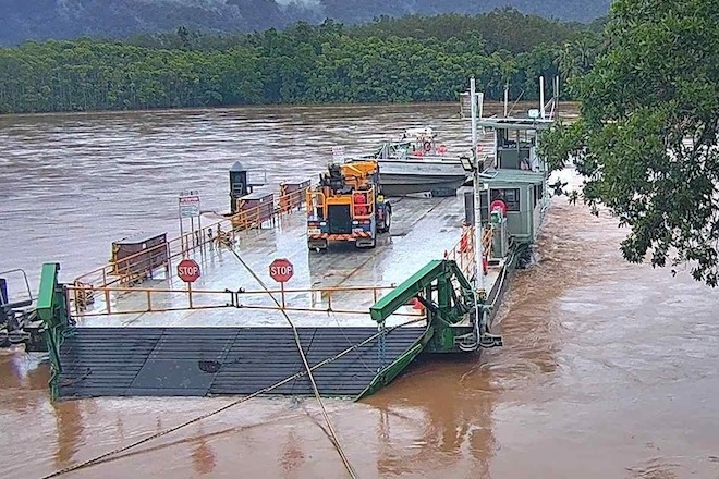
Notably, the North Queensland area has just experienced heavy rain and floods before, causing infrastructure and tourism activities to be affected. Some Daintree River tours have damaged boats and traffic has been disrupted due to rising water.
Experts warn that extreme weather due to storms may continue to disrupt traffic, tours and outdoor activities in this area in the coming days. Visitors are recommended to closely monitor weather forecasts and storm forecasts before planning their travel.


