According to the storm forecast, the latest low pressure from the Joint Typhoon Warning Center (JTWC), a tropical depression being monitored in the Pacific Ocean has strengthened into a storm.
As of this morning, March 17, the center of storm 27P (strengthened from low pressure Invest 96P) is located about 1,269 km east-northeast of Cairns (Australia). The strongest wind near the storm center reaches 75 km/h and is forecast to continue to strengthen.
In the past 6 hours, the storm has moved in a West-Northwest direction at a speed of 13 km/h. JTWC forecasts that this storm will continue to strengthen fiercely as it moves towards mainland Australia.
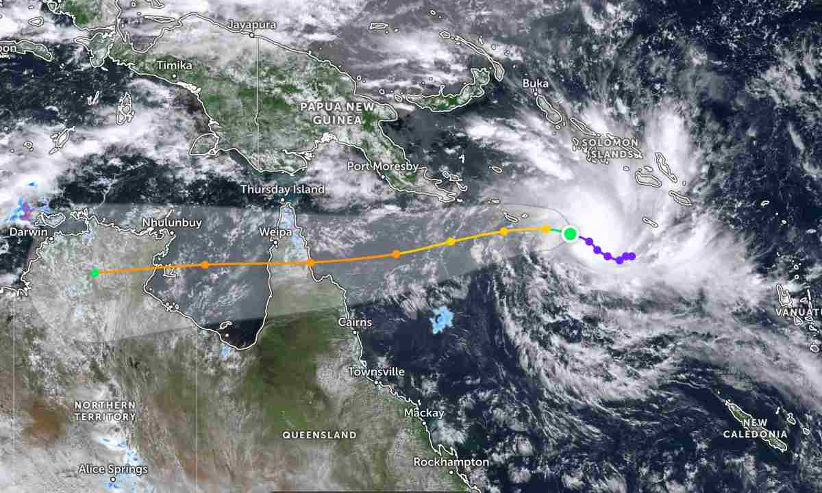
Because it is still quite far from the mainland, the storm has not affected the mainland areas around the area.
In the East Sea, according to the National Center for Hydro-Meteorological Forecasting, on the day and night of March 17, the Gulf of Tonkin area (North and South) will have light rain in some places, visibility over 10 km. East to southeast wind level 3-4, waves 0.5-1.5m high.
The area from Quang Tri to Khanh Hoa has light rain in some places, especially the southern area has scattered showers and thunderstorms. Northeast to easterly wind level 4-5, waves 1.0-2.0m high.
From Lam Dong to An Giang, there will be showers and thunderstorms in some places. Northeast to southeast wind level 4-5, waves 1.0-2.5m high.
The East Sea area (including the North, Central and South of the East Sea, Hoang Sa, Truong Sa) has showers and thunderstorms in some places, especially the North East Sea has less rain in some places. Northeast wind level 3-5, waves 1.0-2.5m high.
Some areas have waves 2.0-2.5m high, accompanied by thunderstorms that can reduce local visibility, causing danger to boats. People and tourists need to monitor weather developments, follow local instructions and avoid going out when the sea is rough to ensure safety.


