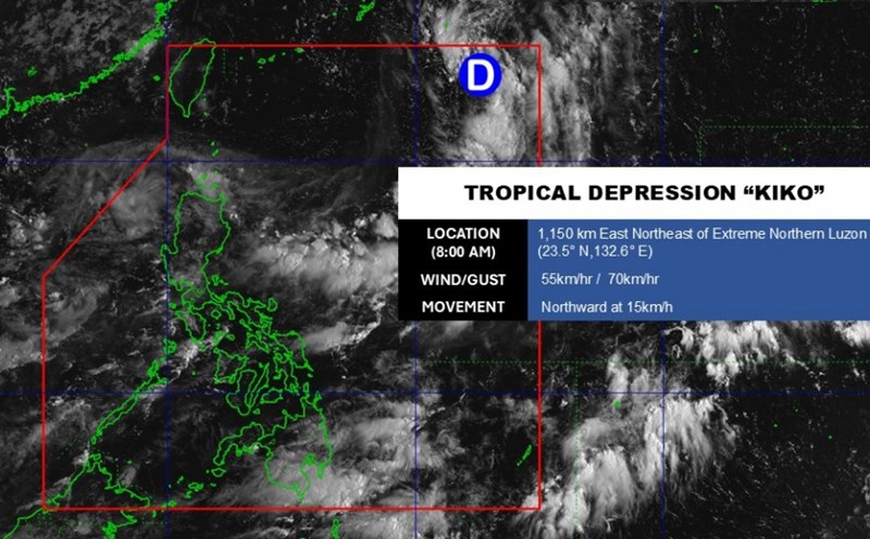
According to the latest weather forecast from the National Center for Hydro-Meteorological Forecasting, at 7:00 a.m. on September 6, the center of the tropical depression was at about 17.7 degrees North latitude - 117.6 degrees East longitude, in the northeastern sea of the East Sea. The strongest wind is level 7 (50-61 km/h), gusting to level 9.
The tropical depression is moving northwest at a speed of 10-15 km/h.
It is forecasted that by 7:00 a.m. on September 7, the tropical depression will move northwest at a speed of 10-15 km/h and is likely to strengthen into storm No. 7. The center of the storm is located at 19.4 degrees North latitude - 115.1 degrees East longitude, about 430 km northeast of the Hoang Sa archipelago.
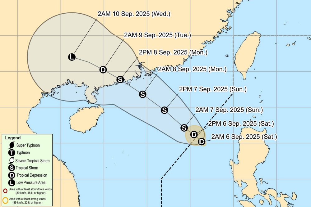
The strongest wind near the storm center is level 8, gusting to level 10. Natural disaster risk level: level 3 for the northeastern sea of the East Sea.
At 7:00 a.m. on September 8, the storm continued to move northwest, at a speed of about 15 km/h and strengthened. The center of the storm is located at about 21.8 degrees North latitude - 112.0 degrees East longitude, in the coastal area of Guangdong province (China).
The strongest wind near the storm center is level 9, gusting to level 11. Natural disaster risk level: level 3 for the northern sea area of the East Sea.
Warning in the next 48-72 hours, the storm will move in a West-Northwest direction, at a speed of about 15 km/h.
Due to the influence of the tropical depression about to become a storm, the northeastern sea of the East Sea will have strong winds of level 6, then increase to level 7-8, gusting to level 10; waves 2.0-4.0 m high, rough seas. Ships operating in the dangerous area are likely to be affected by thunderstorms, whirlwinds, strong winds and large waves.
People and tourists planning to visit the above sea areas should pay attention to weather forecasts. Tuan follows local instructions to ensure safety.