According to the latest storm information from the Joint Typhoon Warning Center (JWTC), at 1:00 p.m. on November 25 (local time), fina weakened into a tropical depression as it moved inland from the northeastern coast of Kimberley.
By the evening of November 25, the center of the tropical depression was about 411 km southwest of Darwin. The tropical depression is moving southwest at a speed of 4 km/h.
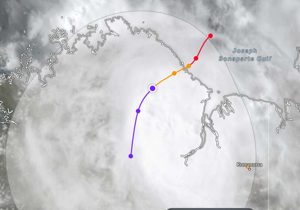
According to the Australian Bureau of Meteorology (BOM), as of 2am this afternoon, the center of the tropical depression was at about 14.7 degrees South latitude - 127.4 degrees East longitude, about 45 km southwest of the Berkeley River mouth and 115 km northwest of Wyndham.
The strongest wind near the center of the tropical depression reached 55 km/h, gusting up to 85 km/h. The low pressure is moving southwest at a speed of 6 km/h.
After moving inland and towards higher terrain, the tropical depression will continue to weaken. The tropical depression is forecast to gradually dissipate tomorrow night, November 26.
However, due to the influence of the tropical depression, heavy rain may continue in the southwestern area of the depression center until tomorrow morning, November 26. Severe weather warnings are still maintained by local authorities in the low pressure area.
The Western Australian Environmental Emergency Management and Change Agency (DFES) recommends that people and tourists should clearly understand safety warnings and bad weather warnings. Avoid going out when not necessary and follow local instructions to avoid dangerous storms.


