According to the National Center for Hydro-Meteorological Forecasting, at 1:00 p.m. this afternoon, the center of the tropical depression was at about 10.4 degrees North latitude - 121.3 degrees East longitude, in the western sea of the central Philippines. The strongest wind near the center of the tropical depression is level 7 (50-61km/h), gusting to level 9. The tropical depression is moving in a West-Northwest direction at a speed of about 30km/h.
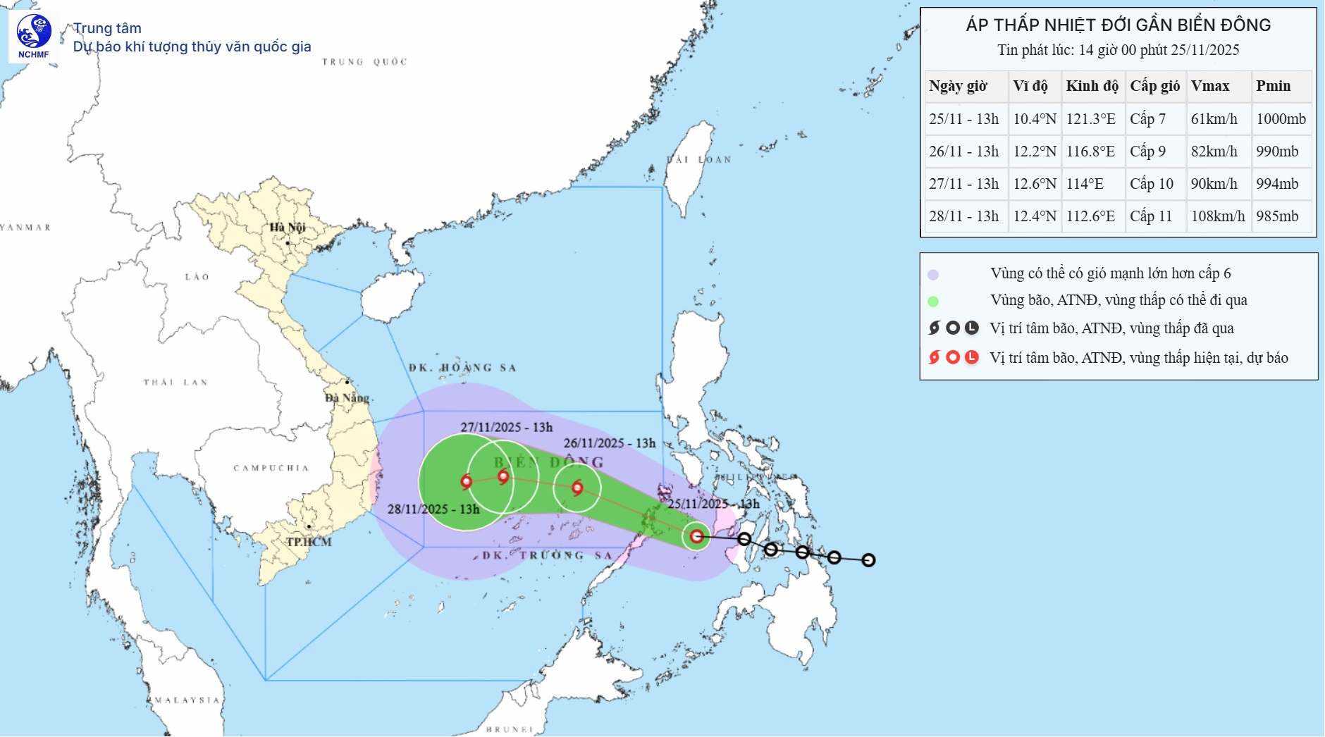
As of 1:00 p.m. on November 26, the tropical depression was moving in the West Northwest direction at a speed of about 20-25 km/h, entering the East Sea. The center of the tropical depression is located at about 12.2 degrees North latitude - 116.8 degrees East longitude, in the eastern sea area of the Central East Sea. The tropical depression is likely to strengthen into storm No. 15.
The strongest wind near the storm center is level 9, gusting to level 11. Natural disaster risk level: Level 3 for the eastern sea area of the Central East Sea (including the northeastern sea area of Truong Sa).
At 1:00 p.m. on November 27, the storm moved in a West-Northwest direction at a speed of about 10-15km/h. The strongest wind near the storm center is level 10, gusting to level 12. Natural disaster risk level: level 3 for the Central East Sea area (including the sea area north of Truong Sa special zone).
The Philippine Atmospheric, Geophysical and Astronomical Services Administration (PAGASA) forecasts that storm No. 15 will strengthen into a severe tropical storm at 11:00 a.m. on November 27 (local time). Maximum sustained winds are 89-117 km/h.
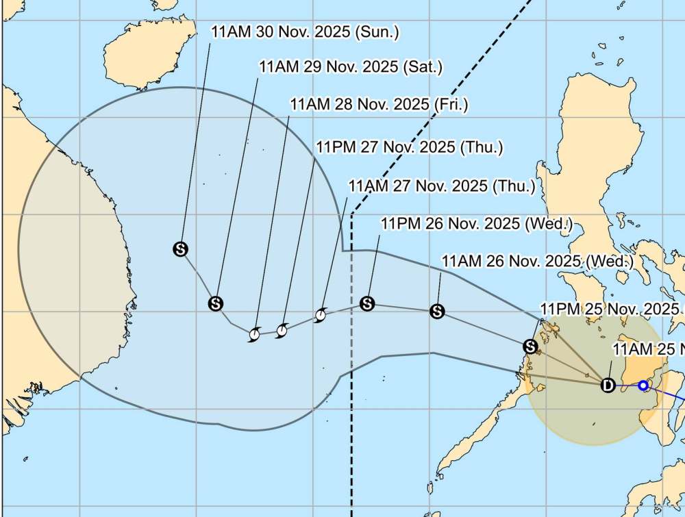
Storm No. 15 will maintain this intensity until November 28.The storm moves slowly to the West, traveling 5-10km per hour and is likely to continue to strengthen.By noon on November 29, the storm will weaken into a tropical storm before approaching the mainland of Vietnam.
Due to the influence of the storm, from the evening of November 25, the sea area east of the Central East Sea will have winds gradually increasing to level 6-7; the area near the center of the storm will have strong winds of level 8-9, gusts of level 11, waves 4.0-6.0m high, very rough seas.
In the afternoon of November 26-28, the Central East Sea area (including the northern sea area of Truong Sa) is likely to be affected by strong winds of level 10-11, gusts of level 14, waves 7.0 9.0m high, and rough seas.
Ship operating in the above-mentioned dangerous areas are likely to be affected by thunderstorms, whirlwinds, strong winds, and large waves.
People and tourists should pay attention to weather forecasts. Do not go to sea when it rains heavily or with big waves and follow local instructions to ensure safety.


