According to the new low pressure forecast from the Philippine Atmospheric, Geophysical and Astronomical Services Administration (PAGASA), a low pressure formed off the coast of Central Luzon and was within the Philippine Area of Responsibility (PAR) in the early morning of Monday, June 30.
At 8:00 a.m. this morning, the low pressure area was determined to be about 1,225 km east of Central Luzon. At about 15.5 degrees North latitude, 132.6 degrees East longitude.
PAGASA weather expert Daniel James Villamil said that in the next 24 hours, there is little chance that this low pressure will strengthen into a tropical depression.
However, the low pressure trough is expected to bring scattered showers and thunderstorms with cloudy skies in the areas of Bicol, Eastern Visayas, Aurora and Quezon.
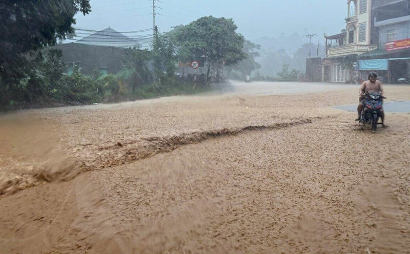
Although the low pressure has not yet affected the East Sea, the weather in the Gulf of Tonkin and the eastern sea area of the Central East Sea is having showers and thunderstorms on June 30, according to the National Center for Hydro-Meteorological Forecasting.
In the Phu Quy special area, the southwest wind has been recorded at level 5, sometimes gusting to level 6.
It is forecasted that during the day and night of June 30, the Gulf of Tonkin, the North and Central East Sea (including Hoang Sa special zone and the North sea area of Truong Sa special zone), the East of the South East Sea, and the Gulf of Thailand will have scattered thunderstorms.
In the sea area from Lam Dong to Ca Mau, there are strong southwest winds of level 5, sometimes gusting to level 6-7. Waves are 1.5 - 2.5m high, with sea level.
Fishermen and tourists in the above areas need to pay attention to the risk of boats being affected by tornadoes, strong gusts of wind, and big waves in heavy rain.