At 3:00 p.m. on January 2 (local time), a low pressure area was identified at a location about 215 km east-northeast of Hinatuan City, Surigao del Sur Province (Philippines).
The East wind is affecting the rest of the Philippines.
The Philippine Atmospheric, Geophysical and Astronomical Services Administration ( pagasa) said that the low pressure area is located in the Intertropical Convergence Zone (ITCZ).
The low pressure is unlikely to develop into a tropical depression or tropical storm in the next 24 hours.
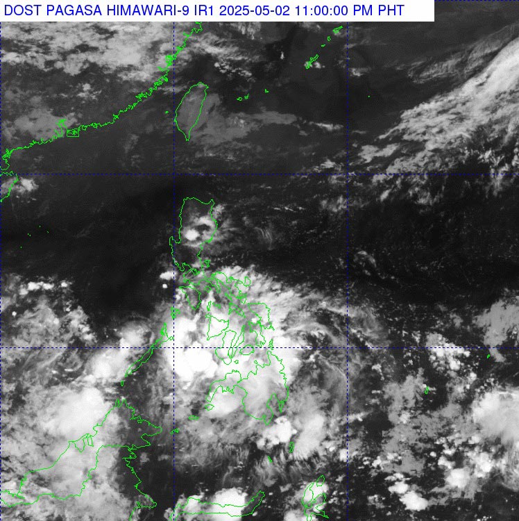
However, this low pressure area will cause scattered showers accompanied by thunderstorms in the Eastern and Central Visayas, Northern Mindanao, Caraga, Davao region...
The rest of Visayas and Mindanao will also see scattered showers and thunderstorms due to the influence of the tropical convergence zone.
Pagasa warned that moderate to heavy rains in the above areas could cause flash floods or landslides.
The remaining areas of the Philippines will have scattered showers or thunderstorms due to the influence of the East wind.
In particular, the hot weather is experienced in this island nation. Temperature index is forecast to range from 42°C to 45°C in more than 20 areas in the Philippines.
Temperature is forecast to peak at 45°C in Infanta (Quezon province) and 44°C in Iba (Zambales province) along with Ambulong, Tanauan ( Batangas province).
Tourists in the Philippines closely monitor weather forecasts and prepare full raincoats and umbrellas when traveling outdoors, and consider adjusting their schedules if necessary - especially for domestic flights or sea journeys.
Currently, the low pressure has not affected the weather in Vietnam's sea areas.
However, people and tourists in some coastal areas of Vietnam need to pay attention to the current weather situation.
According to the National Center for Hydro-Meteorological Forecasting, on May 2, the Central and South East Sea (including the Truong Sa archipelago), the sea area from Binh Dinh to Ca Mau, and the Gulf of Thailand will have showers and thunderstorms.
On the night of May 2 and May 3, in the southern sea area of the Central East Sea, the southern East Sea (including the Truong Sa archipelago), the sea area from Binh Dinh to Ca Mau, Ca Mau to Kien Giang and the Gulf of Thailand, there will be scattered showers and thunderstorms.
During thunderstorms, there is a possibility of tornadoes and strong gusts of wind of level 6-7.
tornado at sea, strong gusts of wind level 6-7, dangerous for ships and maritime activities.

