According to storm news, the latest low pressure from the Joint Typhoon Warning Center (JTWC), two low pressures are operating strongly near the East Sea.
The first low pressure, coded Invest 92W, is currently operating near Guam Island. The strongest wind near the center of the low pressure reaches 35 km/h, gusting up to 45 km/h.
The low pressure moves in a West-Northwest direction, towards the Philippine area of responsibility.
JTWC forecasts that the low pressure has a moderate possibility of developing strongly into a tropical depression or storm in the next 24 hours.
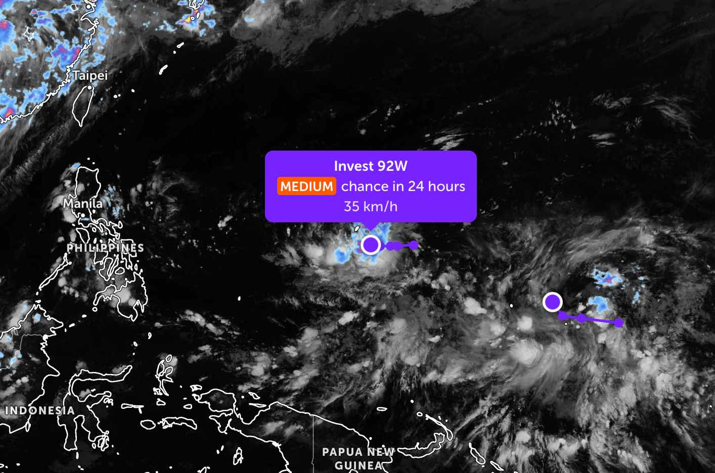
The second low pressure, coded Invest 93W, is currently operating in the western Pacific region. The strongest wind near the center of the low pressure reaches 30 km/h.
The low pressure is assessed to have a low probability of developing into a tropical depression or storm within the next 24 hours.
Because it is still quite far from the mainland, the two low pressures only cause thunderstorms at sea, not affecting much the adjacent mainland areas.
In the East Sea, according to the National Center for Hydro-Meteorological Forecasting, on the evening of June 18, the north of the Northern East Sea area and the Gulf of Thailand will have scattered showers and thunderstorms.
Forecast for the night of June 18 and day of June 19, the sea area north of the Northern East Sea, the area of the Northern Gulf of Tonkin, the sea area from Lam Dong to Ca Mau, Ca Mau to An Giang, the Gulf of Thailand and the South East Sea area (including Truong Sa special zone) will have scattered showers and thunderstorms. In thunderstorms, there is a possibility of tornadoes, strong gusts of wind at level 6-7, sea waves over 2.0m high.
In addition, on the night of June 18 and day of June 19, the area of the Northern Gulf of Tonkin will have strong south winds at level 5, sometimes level 6, gusting at level 7; sea waves 2.0-3.0m high; rough seas.
All ships operating in the above areas are at risk of being affected by tornadoes, strong gusts of wind and high sea waves.
People and tourists planning to visit these sea areas should follow the weather forecast. Follow local instructions and avoid going out to sea when the sea is rough to ensure safety.


