The two low pressure areas are being monitored in the Philippine Area of Responsibility on May 7, according to the Philippine Atmospheric, Geophysical and Astronomical Services Administration ( pagasa).
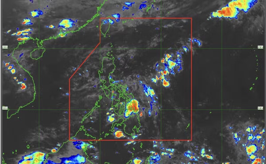
As of 3:00 a.m. on May 7 (local time), the two low pressure areas were identified 425 km west of Iba, Zambales and off the coast of kalibo, Aklan, according to Benison Estareja, a Pagasa weather expert.
Mr. Estareja said that the low pressure area off the Zambales may exit the Philippine Area of Responsibility (PAR) within 24 hours.
In addition, the low pressure area off the coast of Aklan will only move within the Visayas region before gradually dissipating, but it will cause rain before weakening.
While the low pressure area is unlikely to develop into a tropical storm, it is still expected to bring rain to most of southern Luzon and the Visayas, Estareja said in Pagasas weather forecast.
The depression will only remain in the Visayas and Mimaropa regions (including Occidental Mindoro, Oriental Mindoro, Marinduque, Romblon, Palawan) until it weakens by noon or tomorrow afternoon (May 8), he added.
Although the impact of the low pressure on Vietnam's sea weather is not yet clear, people and tourists should pay attention to the weather forecast for the night of May 7 and 8.
Most coastal areas will have scattered showers and thunderstorms, a long view of over 10km, weak to moderate winds (level 3-5), waves from 0.5 - 2.0m high.
The North and South Gulf of Tonkin will have southeast to south winds of level 4-5, waves 1.0 - 2.0m high.
The sea area from Quang Tri to Ca Mau and the southern coastal area will have winds of level 3-4, waves 0.5 - 1.5m high.
The North East Sea will have scattered showers, some places will have strong thunderstorms with the possibility of tornadoes and gusts of wind, with a view reduced to 4-10km in rain.
Hoang Sa archipelago, Truong Sa archipelago, Central East Sea area, South East Sea area have stable weather, light winds.


