According to the latest storm and low pressure forecast from the Philippine Atmospheric, Geophysical and Astronomical Services Administration (PAGASA), the low pressure near the East Sea is likely to form between May 16 and May 22.
The Philippine Meteorological Agency said that the new low pressure is likely to appear within the PAR and then approach Eastern Visayas and Eastern Luzon. Despite its large area of influence, this low pressure near the East Sea is unlikely to strengthen into a storm during the forecast period.
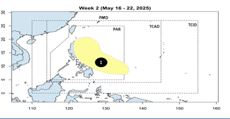
Previously, PAGASA's storm forecast bulletin on May 7 said that a new low pressure is about to form and is likely to enter the East Sea during the week of May 14 to May 20.
This low pressure is assessed to have little chance of strengthening into a storm but tends to move northwest, approaching the Visayas and Southern Luzon regions.
However, throughout the forecast period, this low pressure will move northwest, with the possibility of sweeping across the Philippines and entering the East Sea.
PAGASA forecasts that in May, there may be 1 to 2 storms forming in the PAR area. If it forms, the first storm will be named Auring, followed by Bising.
According to the season forecast of the National Center for Hydro-Meteorological Forecasting, from May to July 2025, storms/tropical depressions are likely to operate in the East Sea and affect our country at a level close to the average of many years (over the East Sea: 3.2 storms, making landfall: 1.2 storms).
According to the representative of the meteorological agency, there is a possibility of a storm or tropical depression appearing early in late May or early June, but the probability is not too high.
From May to July 2025, moderate to heavy rains are likely to appear in the Northern, North Central, Central Highlands and Southern regions.
In May 2025, hot weather is likely to appear nationwide, from June 2025, the heat will decrease in the Central Highlands and the South. The heat in the Northern and Central regions will continue until around August, and from September 2025, the heat will gradually decrease.
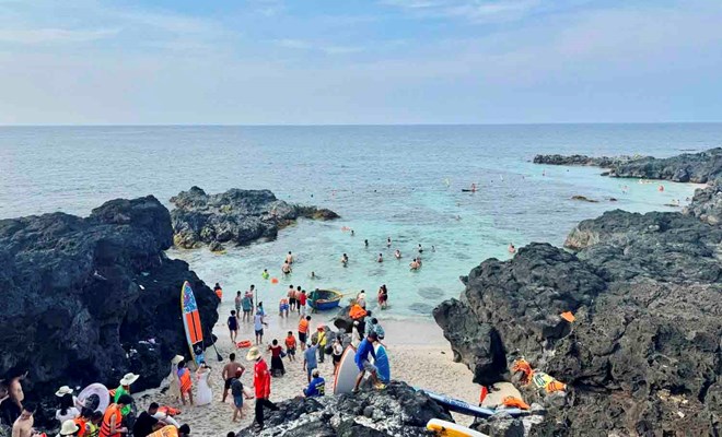
When planning a trip in the summer (usually from May to August), tourists should pay attention to weather forecasts and natural disaster situations to ensure a safe, smooth and complete trip.
Avoid Schedule to areas that are often affected by heavy rain, flooding, and landslides during the rainy season (such as the Northwest and Central regions in November-March).
Summer is the peak tourist season, visitors should book in advance for hotels, air tickets, tours... as soon as possible to avoid running out of rooms and services.
If you don't like jostling, you can choose to travel to emerging locations, mountainous areas, ecological regions, farms...


