According to the National Center for Hydro-Meteorological Forecasting, today, July 17, a tropical depression is being monitored in the eastern part of the Philippines.
It is forecasted that by 4:00 p.m. this afternoon, the tropical depression will move in the West Northwest direction at a speed of 15-20km/h.
The center of the tropical depression is located at about 15.0 degrees North latitude - 126.5 degrees East longitude, in the sea northeast of the Philippines. The tropical depression is forecast to strengthen into a storm, with an intensity of level 8, gusting to level 10.
From the next 48 to 72 hours, the storm will continue to move mainly in the West Northwest direction, traveling 20-25km per hour and is likely to strengthen as it approaches the East Sea.
If it enters the East Sea, it will be the third storm to hit the sea this year.
It is forecasted that on July 17, scattered showers and thunderstorms will continue to occur in the following areas: the sea area southeast of the North East Sea, the sea area east of the central East Sea, the South East Sea (including the Truong Sa special zone), the sea area from Lam Dong to Ca Mau, from Ca Mau to An Giang, the Gulf of Thailand.
In the sea area from Lam Dong to Ho Chi Minh City and the central East Sea area, there are strong southwest winds of level 5, sometimes level 6, gusting to level 7. Waves are over 2m high.
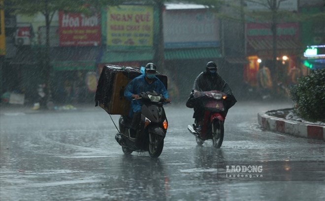
On land, the Northern region will have cloudy weather, with showers and thunderstorms in some places in the evening and at night; in mountainous areas, there will be scattered showers and thunderstorms, with some places having heavy rain; hot sunny during the day.
The area from Thanh Hoa to Hue and the South Central Coast will be cloudy, with showers and thunderstorms in some places in the evening and at night; hot sunny during the day, some places will be very hot.
Other areas will have cloudy weather, with scattered showers and thunderstorms; in the afternoon and evening, there will be scattered showers and thunderstorms, with some places having heavy rain.
People and tourists should be on guard against thunderstorms with the possibility of tornadoes and strong gusts of wind. High waves are dangerous for ships.
Weather forecast for today, July 17:
Hanoi City
Lowest temperature: 27-29 degrees Celsius Highest temperature: 34-36 degrees Celsius, some places above 36 degrees Celsius Cloudy, showers and thunderstorms in the evening and at night; hot sunny during the day.
Light wind.During thunderstorms, there is a possibility of tornadoes, lightning, hail and strong gusts of wind.
Northwest
Lowest temperature: 24-27 degrees Celsius, some places below 23 degrees Celsius Highest temperature: 33-36 degrees Celsius, some places above 36 degrees Celsius Cloudy, scattered showers and thunderstorms at night, locally heavy rain; hot sunny day.
Light wind.During thunderstorms, there is a possibility of tornadoes, lightning, hail and strong gusts of wind.
Northeast
Lowest temperature: 26-29 degrees Celsius Highest temperature: 33-36 degrees Celsius, some places above 36 degrees Celsius Cloudy, showers and thunderstorms in the evening and at night; scattered showers and thunderstorms in mountainous areas, locally heavy rain; hot sunny day.
Light wind.During thunderstorms, there is a possibility of tornadoes, lightning, hail and strong gusts of wind.
Thanh Hoa to Hue
Lowest temperature: 26-29 degrees Celsius Highest temperature: 34-37 degrees Celsius, some places above 37 degrees Celsius Cloudy, showers and thunderstorms in the evening and at night; hot sunny day, some places with severe heat.
Southwest wind level 2-3.During thunderstorms, there is a possibility of tornadoes, lightning and strong gusts of wind.
South Central Coast
Lowest temperature: 25-28 degrees Celsius Highest temperature: 34-37 degrees Celsius, some places above 37 degrees Celsius Cloudy, showers and thunderstorms in the evening and at night; hot sunny day, some places with severe heat.
Southwest wind level 2-3.During thunderstorms, there is a possibility of tornadoes, lightning and strong gusts of wind.
Central Highlands
Lowest temperature: 21-24 degrees Celsius Highest temperature: 28-31 degrees Celsius, some places above 32 degrees Celsius Cloudy, scattered showers and thunderstorms in some places; in the afternoon and evening, there will be scattered showers and thunderstorms, locally heavy rain in some places.
Southwest wind level 2-3.During thunderstorms, there is a possibility of tornadoes, lightning and strong gusts of wind.
Southern region
Lowest temperature: 23-26 degrees Celsius Highest temperature: 29-32 degrees Celsius, some places above 32 degrees Celsius Cloudy, scattered showers and thunderstorms, locally heavy to very heavy rain.
Southwest wind level 2-3.During thunderstorms, there is a possibility of tornadoes, lightning and strong gusts of wind.
Ho Chi Minh City
Lowest temperature: 24-26 degrees Celsius Highest temperature: 30-32 degrees Celsius Cloudy, scattered showers and thunderstorms, locally heavy to very heavy rain.
Southwest wind level 2-3.During thunderstorms, there is a possibility of tornadoes, lightning and strong gusts of wind.


