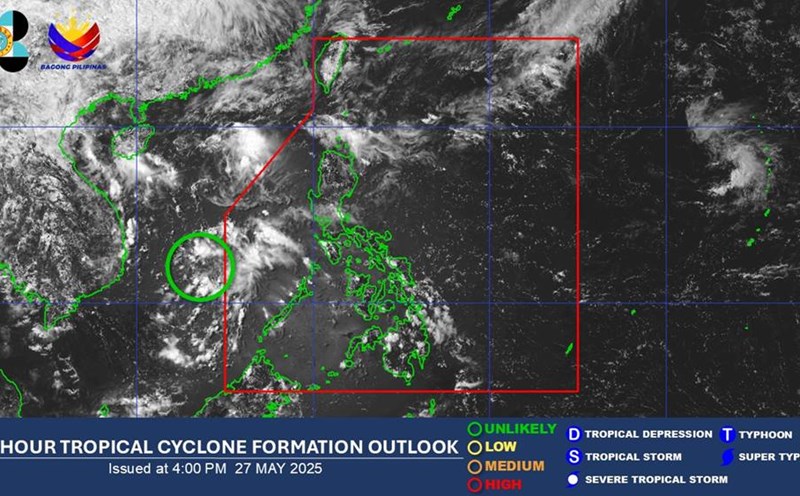
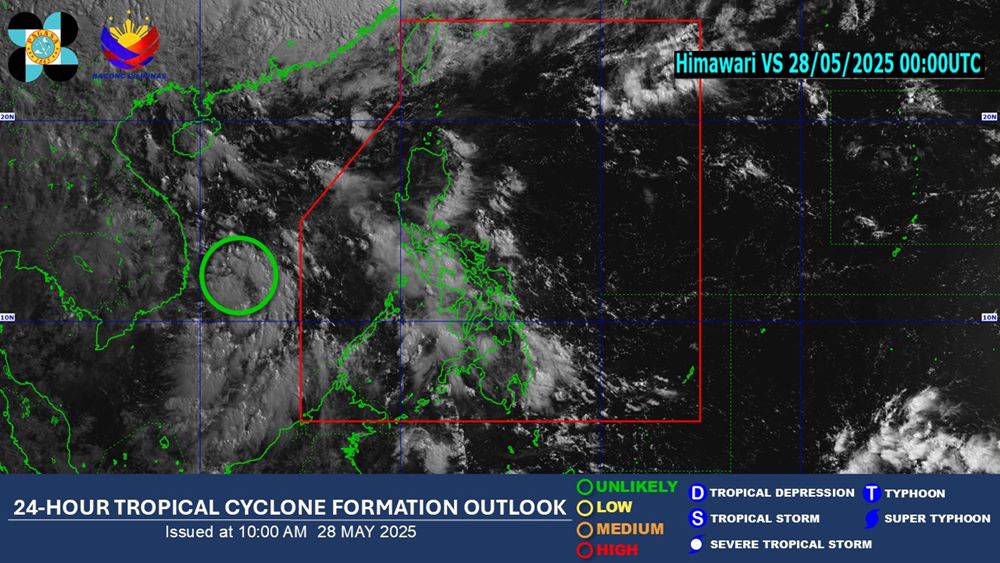
According to the latest weather forecast from the Philippine Atmospheric, Geophysical and Astronomical Services Administration (PAGASA), as of 8:00 a.m. on May 28 (local time), the low pressure area is active in the East Sea, near Truong Sa archipelago.
The low pressure is unlikely to develop into a tropical depression or storm within the next 24 hours.
However, the low pressure area causes gloomy weather, scattered showers and thunderstorms in many areas.
This low pressure area is likely to gradually dissipate over the next few days.
Meanwhile, the US Joint Typhoon Warning Center (JTWC) named the low pressure area Invest 91W. The low pressure is developing with increasingly clear thunderstorm clusters, the center of the tornado is still not clearly defined.
The JTWC forecasts a high chance of the low pressure area developing into a short-term tropical depression, even a small storm could form this weekend, as the low pressure area moves north and then turns northeast towards the Luzon Strait.
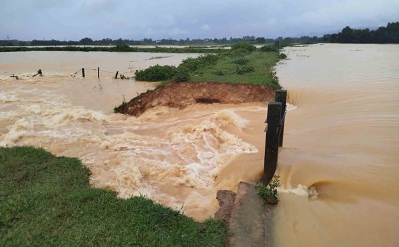
The low pressure appearing in the East Sea affects the weather at sea and on land in Vietnam.
According to the National Center for Hydro-Meteorological Forecasting, during the day and night of May 28, in the Gulf of Tonkin, the sea area from Binh Dinh to Ca Mau, Ca Mau to Kien Giang and the Gulf of Thailand, the North East Sea (including Hoang Sa archipelago), the Central and South East Sea (including Truong Sa archipelago) there will be scattered showers and thunderstorms.
During thunderstorms, there is a possibility of tornadoes, strong gusts of wind of level 6-7, waves over 2.0m high.
On land, from the afternoon of May 28 to May 29, in the Central Highlands and the South, there will be moderate rain, heavy rain and thunderstorms, locally very heavy rain with common rainfall of 30-60mm, locally over 100mm (rain concentrated in the afternoon and evening).
Warning of the risk of local heavy rain (>100mm/3 hours).
People and tourists should be on guard during thunderstorms with the possibility of tornadoes, lightning, hail and strong gusts of wind.
Tourists should update local weather at their destination to adjust their sightseeing and travel plans. Avoid trekking, mountain climbing, and forest travel on May 28-30 due to the risk of landslides and flash floods. Always notify relatives or accommodation establishments of the route to ensure safety in emergency situations.