According to the National Center for Hydro-Meteorological Forecasting, today and tonight 08. 02, cold air will continue to affect other places in the Northwest, North Central and Central Central regions. On land, Northeast wind level 3, coastal areas level 3-4.
From February 08 to the early morning of February 09, the North and North Central regions will have rain, showers, and thunderstorms in some places. From the afternoon of February 08 to February 09, the North will be very cold, with severe cold in mountainous areas; the North Central region from the afternoon of February 08 will turn cold, with very cold in some places.
The lowest temperature in this period in the North is commonly 10-13 degrees C, mountainous areas 7-10 degrees C, high mountainous areas in some places below 3 degrees C; North Central region is commonly 12-15 degrees C.
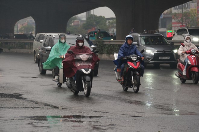
Hanoi area on the day and night of February 8th has rain, showers; from the afternoon of February 8th to February 9th, it will be very cold, with the lowest temperature of 10-12 degrees Celsius.
Day and night 08. 02, Northern region (except Lai Chau, Dien Bien) lowest temperature 10-13 degrees C, mountainous areas 7-10 degrees C, high mountainous areas in some places below 3 degrees C; average temperature 14-16 degrees C, mountainous areas in some places below 13 degrees C. North Central region lowest temperature 12-15 degrees C, average temperature 18-20 degrees C.
Day and night 09.02, the North has the lowest temperature of 12-15 degrees C, mountainous areas in some places below 10 degrees C; North Central region has the lowest temperature of 15-17 degrees C, average temperature 17-19 degrees C.
Due to the influence of cold air, from February 08 to February 09, the area from Ha Tinh to Da Nang City and the eastern provinces from Quang Ngai to Gia Lai will have rain, moderate rain, locally heavy rain and thunderstorms; in thunderstorms, there is a possibility of tornadoes, lightning and strong gusts of wind.
Northern high mountainous areas need to be wary of frost and snow.
At sea, the Northern East Sea area (including the Hoang Sa special zone) has strong Northeast wind at level 7, the northeast sea area sometimes at level 8, gusts at level 9-10, strong rough seas, waves 4-0-6.0 m high. In the Gulf of Tonkin, the Northeast wind gradually strengthens to level 6-7, gusts at level 8-9, strong rough seas, waves 2-0-4.0 m high.
The sea area from South Quang Tri to Dak Lak has Northeast wind level 6, gusts level 7-8, rough seas, waves 3-0-0m high.
The sea area from Khanh Hoa to Ca Mau, the area between the East Sea and the southwest sea area of the East Sea will have Northeast wind level 6, sometimes level 7, gusts level 8-9, strong rough seas, waves 3-0-5.0 m high.
Severe cold, frost, ice and snow can affect livestock, poultry and crops. Localized heavy rain risks causing flooding in low-lying areas, flash floods, landslides and flooding in urban areas and industrial parks.
People and tourists planning to visit the Northern and North Central regions should pay attention to bringing warm clothes and heat-retaining items. Avoid going out at night and near dawn when the temperature drops to the lowest.


