
The US National Weather Service (NWS) warned that super typhoon Bavi is approaching the Mariana Islands. The super typhoon will begin to cause widespread impact today, with the risk of strong winds with catastrophic destructive power.
At 7:00 AM on July 5th, the storm's center was located about 450 km east-southeast of Saipan and about 480 km east of Guam. The super typhoon is moving westward at a speed of about 11 km/h. It is forecast that the typhoon will turn to the Northwest and accelerate slightly as it approaches the Mariana Islands.
NWS noted that Bavi's path could still move north, near Tinian, or south, near Guam in the next 24 hours. Therefore, people throughout the warning area need to complete measures to protect their lives and property before bad weather appears.
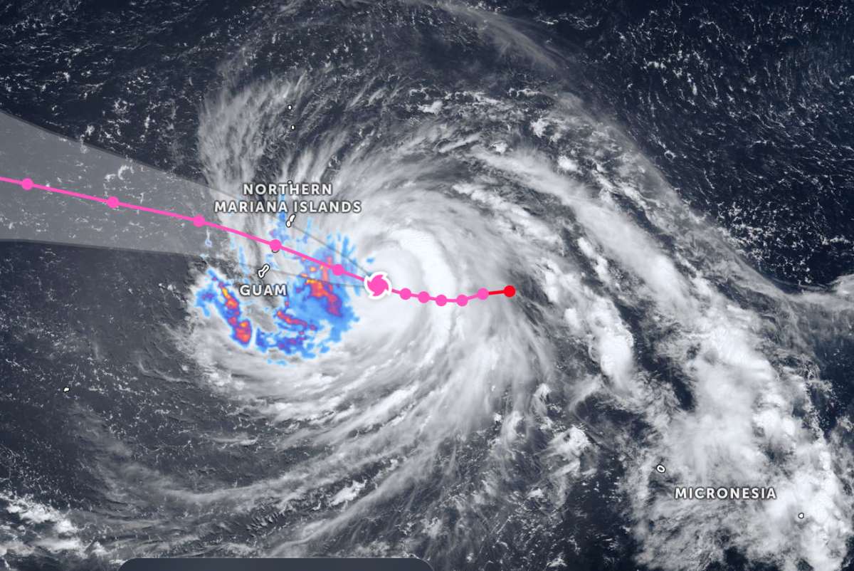
According to forecasts, strong tropical storm winds will begin to affect from the afternoon of July 5 with sustained wind speeds of 96-129 km/h, gusts of up to about 160 km/h. When the storm approaches, many houses with corrugated iron roofs may be destroyed or heavily damaged, trees uprooted, power poles fallen, widespread power outages and outdoor items may be blown away by the wind, causing danger.
In addition to strong winds, the Guam area also faces storm surges of up to about 0.6 m, coastal waves may increase to 3-4.3 m as the storm passes. The NWS also issued flood warnings for the entire area, forecasting accumulated rainfall by the end of July 7 to reach 300-400 mm, increasing the risk of flooding and flash floods.
Storm warnings are effective for Guam, Rota, Tinian, Saipan and nearby waters. The agency assessed that severely damaging winds will spread throughout the Mariana Islands during the day, while islands near the path of the eye of the storm will suffer much more severe weather conditions.
Mr. Landon Aydlett, NWS warning coordinator, said that the entire area from Guam to Saipan will be affected by the storm, with strong typhoon-level winds expected to appear from the night of July 5th to the afternoon of July 6th. Among them, Rota Island is forecast to be closest to the storm center and may suffer all the destructive power of the storm if the eye of the storm passes directly.
Faced with the dangerous developments of super typhoon Bavi, the Guam government opened emergency evacuation centers from the morning of July 5 and called on people living in areas prone to flooding or strong winds to quickly go to safe shelters before weather conditions worsen.


