According to storm news, the latest low pressure from the Joint Typhoon Warning Center (JTWC), Typhoon Mekkhala is about to strengthen into a super typhoon near the East Sea.
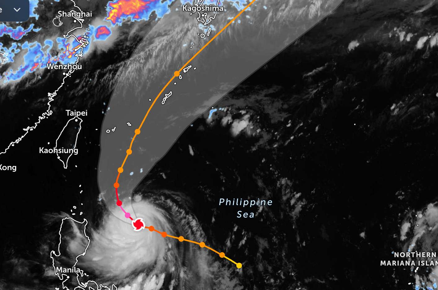
As of the afternoon of June 22, the storm's center was located at about 17.9 degrees North latitude - 126.7 degrees East longitude, about 625 km east of Tuguegarao city, Cagayan (Philippines). The storm is moving in a Northwest direction at a speed of about 17 km/h.
JTWC assesses that Typhoon Mekkhala is in a very rapid intensifying phase. In the next 12 hours, the typhoon will continue to strengthen and is likely to reach maximum intensity after about 24 hours, when the eye of the typhoon is clearly formed.
With the current developments, Typhoon Mekkhala is forecast to reach the super typhoon threshold in the Northwest Pacific Ocean in the next 12 hours. At that time, the strongest wind near the storm center will reach 240 km/h and then strengthen to a maximum of 250 km/h.
In the next 12-24 hours, the super typhoon will move in a North-Northwest direction under the impact of a subtropical high pressure. After that, the high pressure weakens and gradually recedes to the East, creating a weak zone that causes super typhoon Mekkhala to slow down, gradually weaken and gradually change direction. In the next 36 hours, the center of the super typhoon is forecast to cross the high pressure axis before changing direction to the Northeast.
Although the center of Typhoon Mekkhala is forecast not to make direct landfall in the Philippines, the wide circulation of the typhoon still has a significant impact on many areas. The Philippine Meteorological Agency has issued wind warning signal No. 1 for Batanes province and part of Northeast Cagayan, where strong winds from 39-61km/h may appear in the next 36 hours.
The storm also combined with the Southwest monsoon to cause heavy rain and strong gusts on a large scale in many areas of Luzon, Visayas and part of Mindanao.
At sea, waves from 3-4m high appeared in the waters east of Batanes, Babuyan and Cagayan Islands, posing a danger to small boats. Philippine authorities warned Francisco could strengthen into a super typhoon in the next 12 hours before changing direction towards Japan's Ryukyu Islands.
People and tourists planning to travel to the Philippines and Japan during this time should still closely monitor the weather forecast. Check flight schedules regularly and follow local instructions to avoid storms affecting your journey.


