Super typhoon Dudzai recreates with destructive winds

Chí Long |

Typhoon Dudzai once again strengthens to super typhoon level in the Indian Ocean.

According to the latest storm news from the Joint Typhoon Warning Center (JTWC), in the early morning of January 16, Typhoon Dudzai once again strengthened to a super typhoon level in the Indian Ocean.

The center of super typhoon Dudzai is located about 1,128 km south of Diego Garcia. In the past 6 hours, the super typhoon has moved westward at a speed of 1 km/h. The maximum wave height reached 8.5 m.

The strongest wind near the storm center reached 195 km/h.

Anh chup ve tinh sieu bao Dudzai tren bien An Do Duong. Anh: CIRA
Satellite photo of super typhoon Dudzai in the Indian Ocean. Photo: CIRA

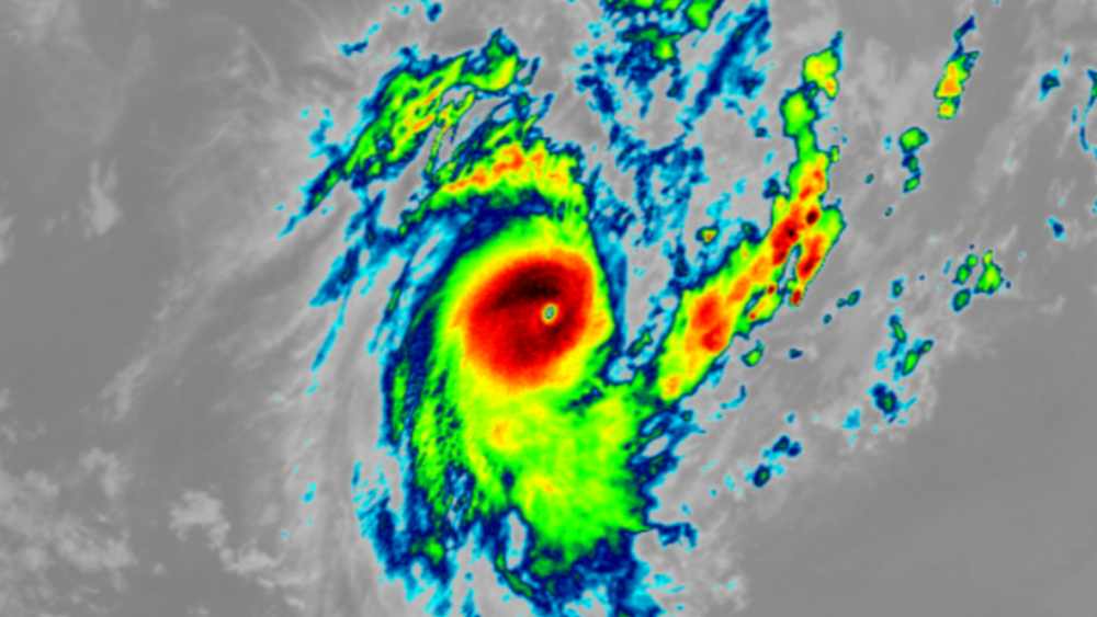
This is the 2nd time Typhoon Dudzai has achieved super typhoon intensity. Previously, this super typhoon had achieved the strongest wind intensity near the center exceeding 220 km/h. This is also the first super typhoon in the Indian Ocean in 2026.

According to forecasts, super typhoon Dudzai will continue to move west along the northern edge of the subtropical high pressure for the next 36 hours. After that, the super typhoon will begin to move southwest and maintain this direction for the next 5 days.

After 2 days of reaching super typhoon-level intensity, Dudzai will begin to reduce wind intensity to cyclone-level. In the next 5 days, the typhoon will continue to gradually weaken but still reach wind intensity above 100 km/h.

Due to being quite far from the mainland, super typhoon Dudzai only caused thunderstorms and big waves in the Indian Ocean.

However, people and tourists planning to travel to the South Indian Ocean should pay attention to weather forecasts. Avoid going out to sea when the sea is rough and follow local instructions to ensure safety throughout the journey.

Chí Long
TIN LIÊN QUAN

Why did Typhoon Nokaen deviate and not enter the East Sea?

|

Storm No. 1 in 2026 in the Northwest Pacific region officially appeared, internationally named Nokaen. The storm was formed from a tropical depression near the East Sea.

Typhoon Nokaen officially forms near the East Sea, heavy rain

|

Typhoon Nokaen officially appeared near the East Sea, in the East Sea area of Mindanao (Philippines).

New low pressure area appears, forecasting more storms to form next week

|

A new low pressure offshore the South Pacific, is highly likely to develop into a strong tropical storm off the coast of Australia early next week.

Why did Typhoon Nokaen deviate and not enter the East Sea?

Ninh Phương |

Storm No. 1 in 2026 in the Northwest Pacific region officially appeared, internationally named Nokaen. The storm was formed from a tropical depression near the East Sea.

Typhoon Nokaen officially forms near the East Sea, heavy rain

Chí Long |

Typhoon Nokaen officially appeared near the East Sea, in the East Sea area of Mindanao (Philippines).

New low pressure area appears, forecasting more storms to form next week

Ninh Phương |

A new low pressure offshore the South Pacific, is highly likely to develop into a strong tropical storm off the coast of Australia early next week.