According to the latest storm news from the Philippine Atmospheric, Geophysical and Astronomical Services Administration (PAGASA), tropical depression Ada has strengthened into Typhoon Nokaen near the East Sea.
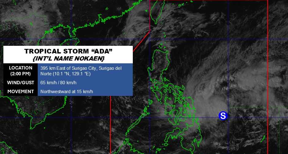
As of 2 pm today, the center of the storm is located at about 10.1 degrees North latitude - 129.1 degrees East longitude, 396 km northeast of Hinatuan, Surigao del Sur.
The strongest wind near the storm center reaches 65 km/h, gusting up to 80 km/h. The storm moves in a Northwest direction at a speed of about 15 km/h.
This is the first storm to enter the Philippine waters in 2026. Due to the storm's impact, heavy rain will appear throughout Eastern Samar, Dinagat Islands, Surigao del Norte and Surigao del Sur. The maximum rainfall may reach 100-200 mm.
Areas with rainfall from 50-100 mm include: Northern Samar, Eastern Samar, Samar, Biliran, Leyte, Southern Leyte, Dinagat Islands, Northern Surigao, Northern Agusan and Southern Surigao, Northern Camarines, Southern Camarines, Albay, Masbate, Sorsogon, Samar, Biliran, Leyte, Southern Leyte and Dinagat Islands.
Previously, PAGASA announced 6 areas within Category 1 storm warning, including North Samar, Samar, East Samar, Dinagat Islands, Surigao del Norte and Surigao del Sur.
It is forecasted that the storm will move in a Northwest direction from now until January 18, then head northeast on Monday (January 19). On the forecast route, the storm may pass near Eastern Samar and Northern Samar on January 16 or 17 in the early morning before reaching Catanduanes, which is likely to approach Catanduanes on the morning of January 17. The storm is also likely to make landfall in eastern Visayas and Bicol Region.
Faced with the storm developments, functional agencies are advised to urgently implement all necessary measures to protect the safety of people's lives and property.
Tourists planning to come to the Philippines during this time should pay attention to weather forecasts. Follow local instructions to avoid storms that affect the journey.


