Super typhoon Sinlaku continuously devastated two remote US islands in the Pacific, unleashing strong winds and endless rain, tearing corrugated iron roofs and forcing people to shelter from tree branches blown away by the wind.
In Susupe village on Saipan Island - in the Northern Mariana Islands (USA), the wind blew off the roof of a commercial building and broke many branches. A blue sedan overturned.
A resident filmed a video recording the scene of a car lying on top of two other cars in a parking lot. The wind also swept away part of the balcony railing of this person.
I guess wooden structures and corrugated iron roofs can hardly stand," said a resident who grew up in Saipan. This is the largest island and also the center of the Northern Mariana Islands, famous for resort tourism, diving and golf courses.
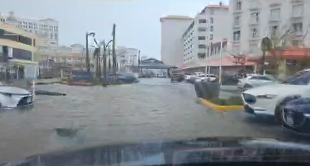
According to a Saipan mayoral office spokesman, preliminary reports show widespread flooding, uprooted trees and fallen power lines. No deaths have been recorded yet.
According to the US National Weather Service, when making landfall, the storm achieved sustained winds of up to about 240 km/h - the strongest among the storms in the world this year.
In Guam - a US territory in the south with about 170,000 people and many military bases - strong tropical storm winds and torrential rain also caused flash floods. Previously, the storm devastated the outer islands and coral reefs of Chuuk State (Federation of Micronesia).
According to the US National Weather Service, winds from 121 km/h or more are expected to continue until the afternoon of April 15 when the storm center moves northwest of Saipan and Tinian.
The eye of the storm is currently about 64 km or more from the shore and is leaving the waters west of Saipan and Tinian. However, typhoon-level winds are still expanding to a radius of about 120 km from the center, causing storm conditions to continue at least until early afternoon.

In Guam, updated at 11 am on April 15 (local time), the sustained wind was still at about 80 km/h, gusting to 120 km/h.
However, storm-force winds will still last until evening, while tropical storm-force winds from about 63-117 km/h will continue in the morning and afternoon of April 16. Even when reduced to about 80 km/h, the wind is still too strong for people to go out safely for at least one and a half days.
After that, the storm will turn towards the more sparsely populated volcanic islands in the northernmost part of the Mariana Islands.
Residents and tourists in Saipan, Tinian and Rota must continue to stay in shelters until there is an official announcement to lift the warning.
In the past 80 years, the US Joint Typhoon Warning Center in Guam has recorded more than 300 super typhoons.
Storms are "very common" in the Pacific, but the peak season usually lasts from summer to autumn, similar to the storm season in the Atlantic, according to international forecasting experts from AccuWeather. Therefore, storms appearing in the Western Pacific in April are quite rare.


