According to the latest storm news, Super Sinlaku has made direct landfall on US islands in the Pacific Ocean, sweeping through Tianian Island and Saipan Island, with winds of about 241 km/h.
The eye of the storm made landfall between Saipan and Tinian (belonging to the Northern Mariana Islands) on Tuesday evening April 14 (local time).
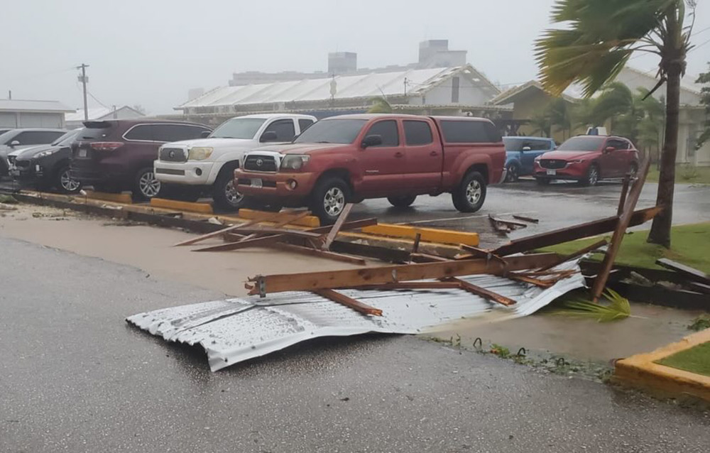
“The storm is very fierce,” Saipan Mayor Ramon “RB” Jose Blas Camacho said. “Safety becomes very difficult with heavy rain and strong winds. Objects fly everywhere.”
He said some people were rescued, but trees were knocked down and many wooden structures and corrugated iron roofs collapsed.
Although later downgraded from super typhoon to strong typhoon, this system still has a very large impact with strong gusts of wind and heavy rain.
Saipan - the largest island in the Northern Mariana archipelago, a popular destination for resorts, diving and golf - is located close to the path of super typhoon Sinlaku, with a slow moving speed of about 5 km/h.
After that, the storm is forecast to change direction to the north and then northeast, going out to the wide sea area east of Japan. The storm is unlikely to enter the East Sea or affect the weather in Vietnam.
At Saipan International Airport, gusts exceeded 160 km/h for more than 10 hours, sometimes up to about 210 km/h. At Guam, maximum gusts were recorded at about 140 km/h.
Weather forecast continues to worsen on April 15. In the south, Guam recorded torrential rain and flash floods taking place.
Heavy rain continues to pour down on the area, with common rainfall of 130 - 300 mm, increasing the risk of widespread flash floods.
In Saipan and Tinian, flash floods are expected to last until Wednesday, April 15. About 50,000 people live on three islands in the area, of which Saipan is the most populous and the main tourist center.
This is the first super typhoon to directly hit Saipan and Tinian since Super Typhoon Yutu in 2018 - a typhoon that caused widespread damage in the area.
As it approached Guam, Sinlaku deviated north and east of the island on Tuesday night, but still caused heavy rain and gusts of wind up to about 130 km/h.
Local authorities called on people and tourists in Saipan and Tinian to stay in safe shelters.
The safest place is a solid room inside, away from windows. Stay in your shelter until dangerous conditions pass," the notice stated.
The storm caused widespread power outages, fallen trees and damage to structures. The US government has declared a state of emergency in Guam and Northern Mariana, and deployed federal support forces.
According to meteorological data, only one storm ever made landfall in Saipan in April was Typhoon Jean in 1968. Most recently, Super Typhoon Yutu (October 2018) caused serious damage, killing 2 people and injuring more than 130 others.
In 2023, Typhoon Mawar also traveled close to northern Guam with intensity equivalent to level 4.
Super typhoon Sinlaku appeared and reached very strong intensity right from the beginning of the season, which is considered unusual, as the Western Pacific region usually only records super typhoons from the summer.


