Pha Luong peak, belonging to Pha Luong village, Chieng Son commune, is likened to the "roof" of Moc Chau plateau. With an altitude of nearly 2,000m, this place possesses majestic, pristine and seasonally changing landscapes, creating a unique attraction for adventurous tourists.
The journey starts from the center of Moc Chau, along National Highway 43 towards Long Sap border gate. The route winds through tea hills, villages and ancient forests. This route passes through Bach Long Glass Bridge, Dai Yem Waterfall, Vat Hong Pagoda, famous scenic spots of the locality.
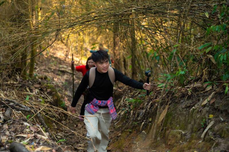
After about 25km, the asphalt road ended, replaced by a nearly 5km long concrete road leading to Pha Luong Border Guard Station. To move easily on the narrow village road, tourists must walk or rent motorbikes from local people.
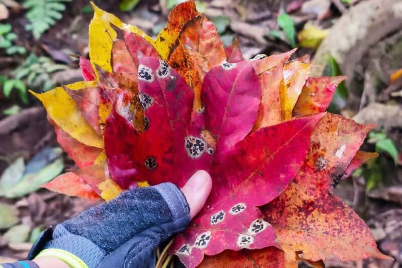
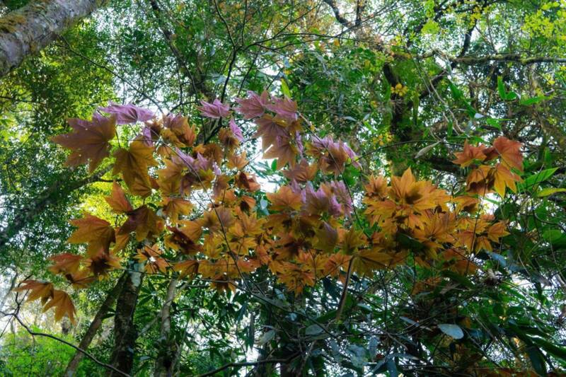
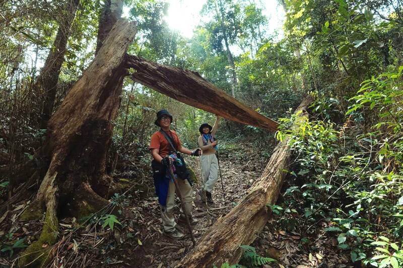
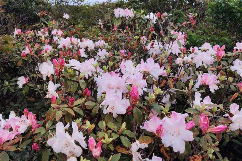
From an altitude of about 1,500m, the climbing journey lasts about 6km. The main route is a forest-crossing trail, moderately steep but continuous. Along the way, visitors encounter maple leaves turning yellow and red mixed with the green of the mountains and forests. The higher you go, the more rhododendron flowers bloom, covering the mountainsides and rock crevices.
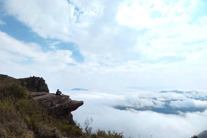
Mr. Giang A Cha, a porter specializing in leading Pha Luong climbing groups, said that the climbing stage is about 3 hours long, at this time the scenery is most beautiful of the year. "Along the way, there are also maple leaves changing color and azaleas blooming. After rainy days, the sky is sunny, from the'Turtle Cape' area, you can hunt the sea of clouds very clearly," he said.
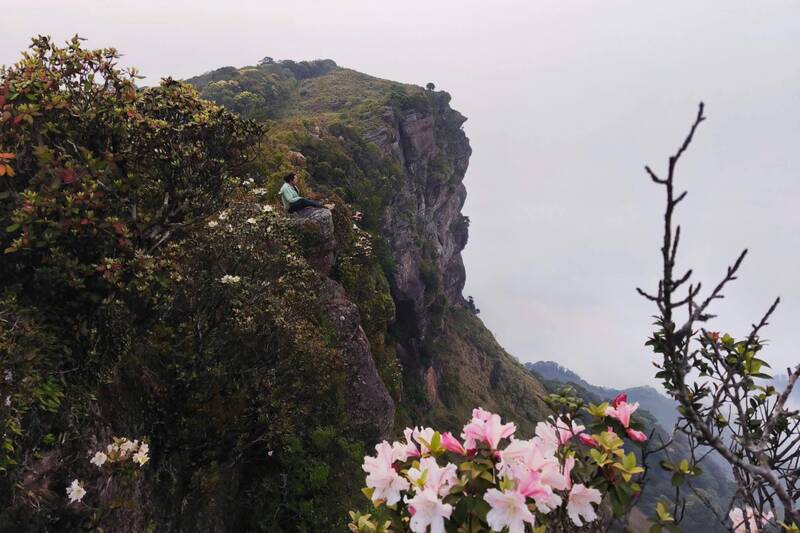
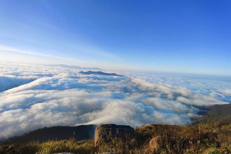
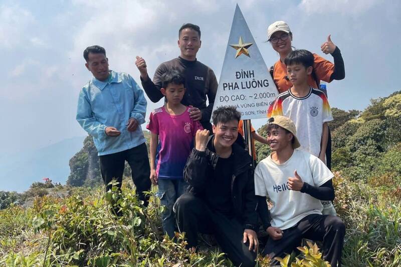
Pha Luong peak is a wide rocky surface with many large stone blocks protruding into the air. "Turtle peak" is a familiar stop for tourists, where you can observe the panoramic view of the Vietnam - Laos border mountains and forests. When the weather is favorable, a sea of clouds appears thick and floating, creating an impressive scene.
Mr. Le Trong Binh, Secretary of the Party Committee of Chieng Son commune, said that the locality is focusing on completing infrastructure and developing community tourism associated with preserving landscapes and cultural identity. "The goal is to effectively exploit tourism potential and improve people's lives," he said.
Experiencing reality, Mr. Ho Xuan Thuy (Phu Tho province) shared that in 2020 I climbed Pha Luong once. This climb, the journey has less strenuous sections and in return the trip is on time, so the scenery is as beautiful as a dream. "From old forests, maple leaves to azaleas and sea of clouds on the top are all very valuable," he said.
According to local people, Pha Luong is not only a tourist destination but also has spiritual meaning, a place of harmony between heaven and earth, preserved by the community for many generations.
To conquer Pha Luong, visitors should spend 2 days and 1 night, prepare appropriate costumes, bring drinks, snacks and personal papers to check in at the border guard station. Accompanying porters or locals is recommended to ensure safety.
With majestic scenery, unique trekking experiences and seasonal beauty, Pha Luong is gradually becoming a prominent destination on the Northwest tourism map.


