According to the latest information from the National Center for Hydro-Meteorological Forecasting, at 10:00 a.m. on October 27, the center of storm No. 6 Tra Mi is currently at about 16.3 degrees North latitude; 108.2 degrees East longitude, located on the coastal area of Thua Thien Hue - Da Nang.
The strongest wind near the storm center reached level 9, equivalent to 75-88km/h, gusting to level 11.
In the next 3 hours, the storm will move to the Southwest, at a speed of about 10-15km/h.
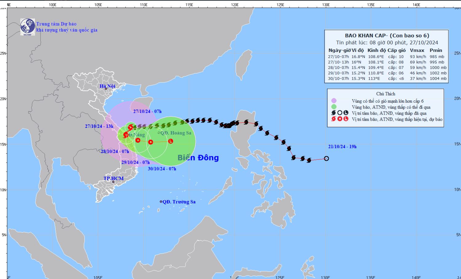
According to the National Center for Hydro-Meteorological Forecasting, due to the influence of storm No. 6, some localities in Vietnam may have strong winds.
Specifically, at Con Co Island (Quang Tri), there are strong winds of level 8, gusting to level 9; Cu Lao Cham Island (Quang Nam) has strong winds of level 8, gusting to level 10; Ly Son Island (Quang Ngai) has strong winds of level 6, gusting to level 7.
On land, Le Thuy (Quang Binh) has strong winds of level 6, gusts of level 8; Thua Thien Hue has strong winds of level 6, gusts of level 8; Ba Na (Da Nang) has strong winds of level 6, gusts of level 13; Cam Le (Da Nang) has strong winds of level 7, gusts of level 9; Hoi An (Quang Nam) has strong winds of level 6, gusts of level 7; Tam Ky (Quang Nam) has gusts of level 7.

For tourists planning to visit the coastal provinces of Northern and Central Vietnam, they should limit sea tourism activities in the coming days.
Residents and visitors need to monitor weather reports and follow the instructions of authorities.
In Thua Thien Hue province, in addition to the functional forces tasked with preventing storm Tra Mi, people are advised not to go out from 7am today. The Hue Monuments Conservation Center announced a temporary suspension of visitors to the relic sites.
In Da Nang, people are required to limit leaving their homes from 10am on October 27.

