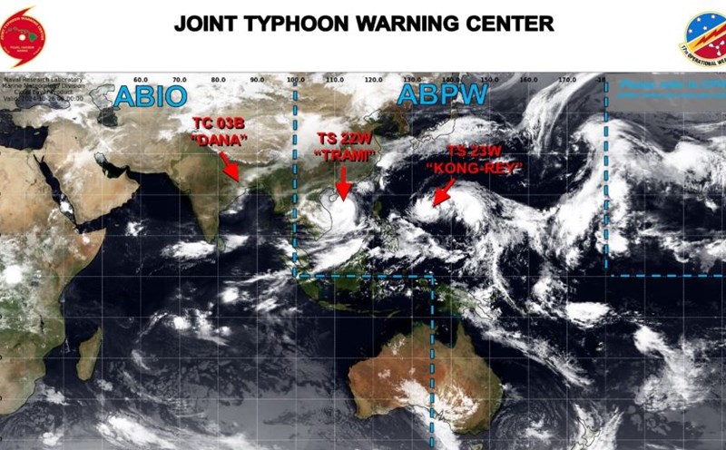
Typhoon Kong-rey is accelerating towards PAR, while maintaining its strength as it continues to move west. The storm will be locally named Leon when it enters the Philippine Area of Responsibility (PAR).
The Philippine Atmospheric, Geophysical and Astronomical Services Administration (PAGASA) said the storm could enter PAR on the evening of October 26 or early morning of October 27, but also predicted that Kong-rey would be far from the Philippine mainland.
PAGASA said tropical storm Kong-rey was moving west at about 30 km/h - faster than the 25 km/h speed on the evening of October 25.
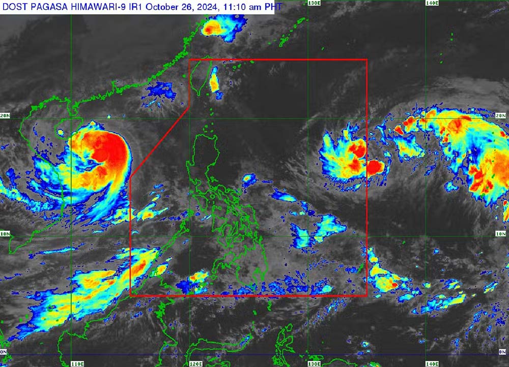
As of 10 a.m. on October 26, the tropical storm was located 1,630 km east of Central Luzon, with maximum sustained winds of 65 km/h near the center and gusts of up to 80 km/h.
This tropical storm could develop into a severe tropical storm on October 27 and continue to strengthen into a hurricane on October 28.
As of the afternoon of October 26, the Philippines has basically restored shipping and fishing activities at sea. The Philippine Coast Guard (PCG) Center Command recorded that no passengers, boats, goods, etc. were stranded at any ports across the country. All shipping and fishing activities have returned to normal.


