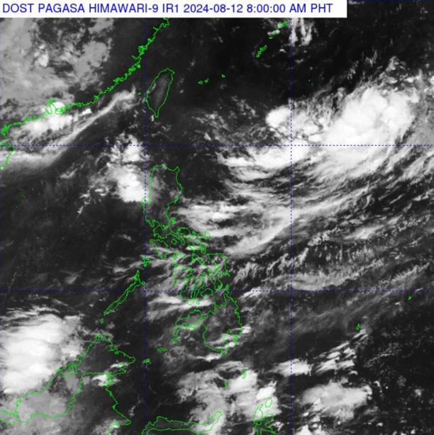
On the morning of August 12, the Philippine Atmospheric, Geophysical and Astronomical Services Administration (PAGASA) announced that it was monitoring a low pressure area in the Philippine Area of Responsibility (PAR).
PAGASA weather expert Robert Badrina said the depression was estimated to be about 1,375 kilometers east of northern Luzon.
This low pressure area could develop into a tropical depression or tropical storm but is also likely to exit the PAR rapidly within the next 24 hours.
If it becomes a tropical storm, it will be named Dindo.
Currently, this low pressure area has no direct weather impact on the Philippines’ mainland. However, the southwest monsoon, locally known as “habagat,” will bring rain and thunderstorms to the regions of Ilocos (a municipality on the northwest coast of Luzon), Zambales and Bataan (Central Luzon).
Due to the habagat, scattered showers and thunderstorms are currently expected in many areas including Metro Manila, the rest of Luzon and Western Visayas. Light to moderate winds and light to moderate sea waves will prevail across the Philippine archipelago.
Tourists planning to explore the Philippines at this time should pay attention to the weather forecast. It is currently the rainy season in this island nation (from June to October). The ideal time to travel to the Philippines is from November to April of the following year, when the temperature is comfortable and there is little rain.