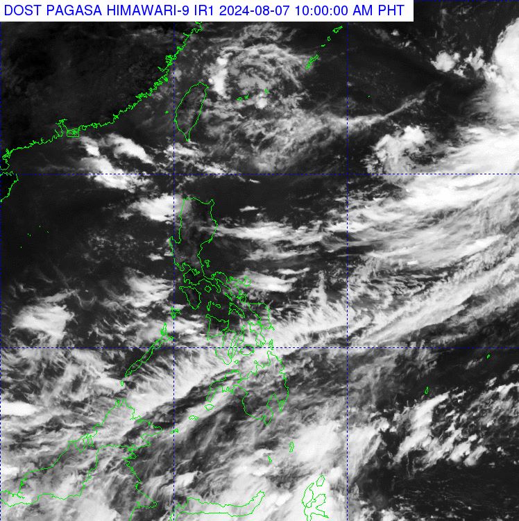
According to the latest report from the Philippine Atmospheric, Geophysical and Astronomical Services Administration (PAGASA), there are currently three low-pressure areas near the South China Sea, with one low-pressure area located within the Philippine area of responsibility.
At 3 am on August 7, this low-pressure area was approximately 575 km northeast of Itbayat, Batanes, Philippines.
PAGASA's weather forecasting expert warned that one of the two low-pressure areas outside the Philippine area of responsibility may develop into a tropical depression.
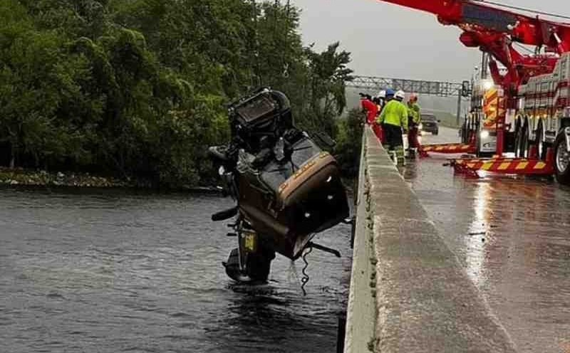
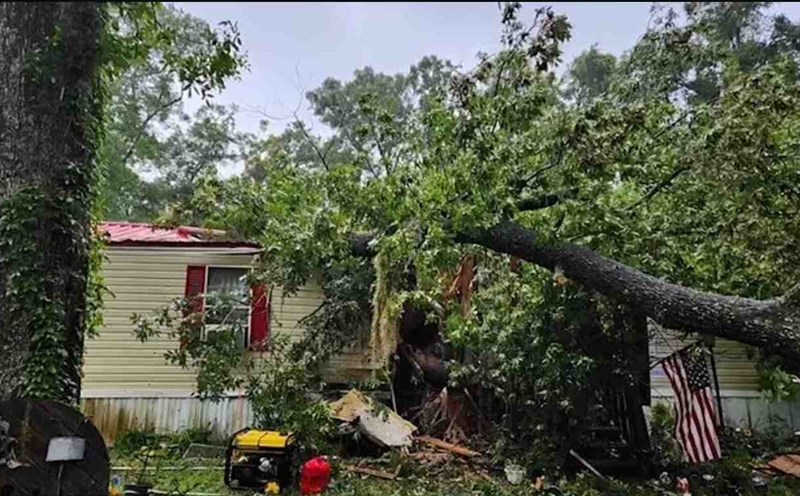
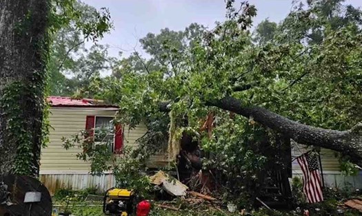
All three low-pressure areas are strengthening the southwest monsoon's influence on the weather in the Philippines, resulting in heavy rainfall in various parts of the country, particularly in Central Luzon, Southern Luzon, and the Visayas.
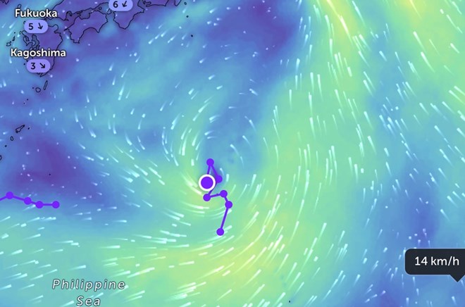
According to PAGASA, a low-pressure system outside the Philippine area of responsibility has officially intensified into a tropical depression, approximately 2,005 km northeast of Northern Luzon. The tropical depression has sustained winds of up to 55 km/h, with gusts reaching up to 70 km/h. However, the tropical depression is nearly stationary.
The Joint Typhoon Warning Center (JTWC) of the United States Air Force and Navy is monitoring this tropical depression. The system has been designated as Invest 94W, with a high likelihood of intensifying into a tropical depression within the next 24 hours.
The Japan Meteorological Agency (JMA) predicts that this tropical depression will intensify into a tropical depression tonight (August 7). The system will be given the international name Maria - Typhoon No. 5 in the northwest Pacific Ocean during the 2024 typhoon season.
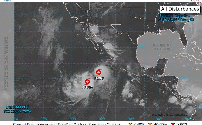
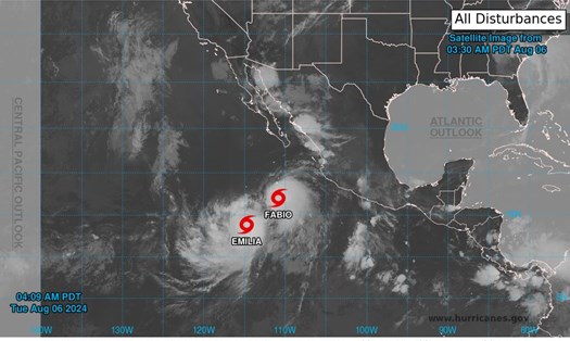
In the eastern Pacific Ocean, there are currently four typhoons and tropical depressions active. Typhoon No. 5 Emilia and Typhoon No. 6 Fabio continue to move in the eastern Pacific Ocean, while Typhoon No. 3 Carlotta and Typhoon No. 4 Daniel have weakened into tropical depressions.
In light of this complex weather situation, tourists are advised to closely monitor weather forecasts and typhoon warnings from relevant authorities.
If you have travel plans to the affected area, consider postponing or changing your itinerary. For tourists currently in areas prone to be affected, follow local government instructions and prepare essential items such as food, water, flashlights, and battery-powered radios.
Avoid coastal areas, rivers, and streams prone to flooding and be prepared to evacuate if necessary. Tourists should also maintain contact with their embassy or consulate for assistance when needed.
Ensure important documents are safely stored and easily accessible in case of an emergency. Update information on transportation, flight schedules, and public transportation that may be affected.
If you are on an island or coastal area, consider relocating to a safer location before the weather worsens.
Tourists must remain vigilant and prioritize their safety in all situations. Closely monitoring the situation and following instructions from authorities is crucial at this time.