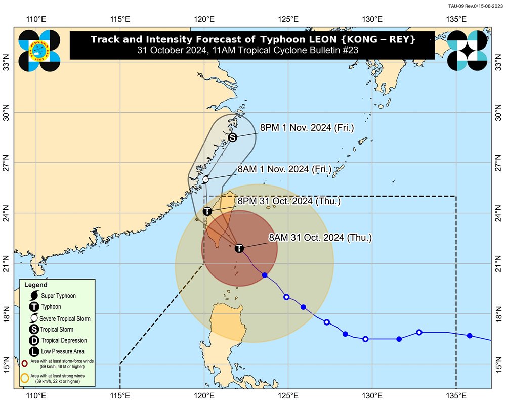
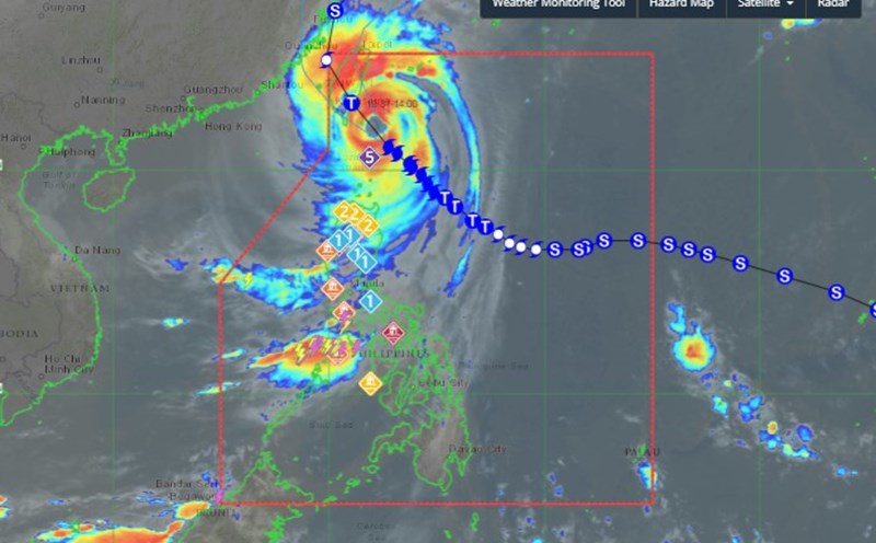
According to the latest weather forecast from the Philippine Atmospheric, Geophysical and Astronomical Services Administration (PAGASA), as of 11:00 a.m. on October 31 (local time), the center of storm Kong-rey was located at approximately 22.2 degrees North latitude - 121.9 degrees East longitude, about 155km north of Itbayat, Batanes.
The storm is moving northwest at a speed of about 25km/h. The strongest wind near the storm's center is maintained at 175km/h, with gusts of up to 215km/h.

Typhoon Kong-rey is forecast to make landfall in eastern Taiwan this afternoon (October 31). After passing over mainland Taiwan, the storm will turn northeast through the Taiwan Strait and head toward the East China Sea, leaving the Philippine Area of Responsibility (PAR) on the night of October 31 or early morning of November 1. It is not ruled out that the storm will make landfall in mainland China during this time.
Typhoon Kong-rey is likely to weaken throughout the forecast period. It will weaken significantly as it passes over the mountains of Taiwan (China).
However, Typhoon Kong-rey is predicted to be the largest storm to hit Taiwan (China) in the past 3 decades.
On October 31, Taiwan (China) announced that public employees would be off work, schools and financial markets would be closed to avoid the storm. All flights connecting cities on the island and international flights were canceled.
In the face of the developments of super typhoon Kong-rey, people and tourists planning to travel to the Philippines and Taiwan (China) during this time should pay attention to weather forecasts and check flight schedules to proactively plan their itinerary and ensure safety.


