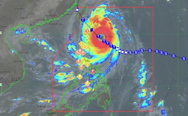
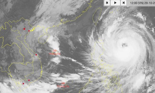
According to the latest weather forecast from the Philippine Atmospheric, Geophysical and Astronomical Services Administration (PAGASA), at 2:00 p.m. on October 30, Typhoon Kong-rey had strengthened into a super typhoon. The center of the storm was located at approximately 19.6 degrees North latitude - 124.4 degrees East longitude, 310 km east of Calayan, Cagayan.
The storm is moving northwest at 15 km/h. The strongest wind near the storm's center is maintained at 185 km/h, with gusts of up to 230 km/h.
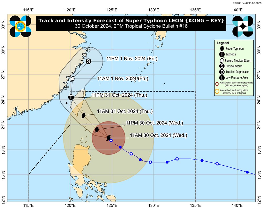
Super Typhoon Kong-rey is expected to move northwest through the Philippine Sea and make landfall on the east coast of Taiwan (China) on the afternoon of October 31. After sweeping across Taiwan (China), the super typhoon will turn north-northwest to northeast, through the Taiwan Strait and towards the East China Sea.
It is not impossible that super typhoon Kong-rey will make landfall in mainland China during this time.
The super typhoon is expected to exit the Philippine Area of Responsibility (PAR) by the evening of October 31 or early morning of November 1. The storm's path is currently uncertain.
Super Typhoon Kong-rey will be closest to Batanes (Philippines) from late evening October 30 to morning October 31. It is not ruled out that the storm will make landfall in Batanes.
The super typhoon will reach near or peak intensity as it makes its closest approach to Batanes. It will weaken as it makes landfall in Taiwan (China).
According to CNN, super typhoon Kong-rey is expected to make landfall in Taitung, a sparsely populated county on the southeastern coast of Taiwan (China), early in the morning of October 31.
"As the storm continues to move northwest, almost all of Taiwan will be swept by the storm tonight (October 30)," said Chu Mei-lin, a meteorologist at the Taiwan Weather Bureau.
Taiwan's China Weather Administration (CWA) has issued a sea warning as the typhoon draws closer. As of noon on October 30, the agency has issued land warnings for many locations on the island of Taiwan (China).
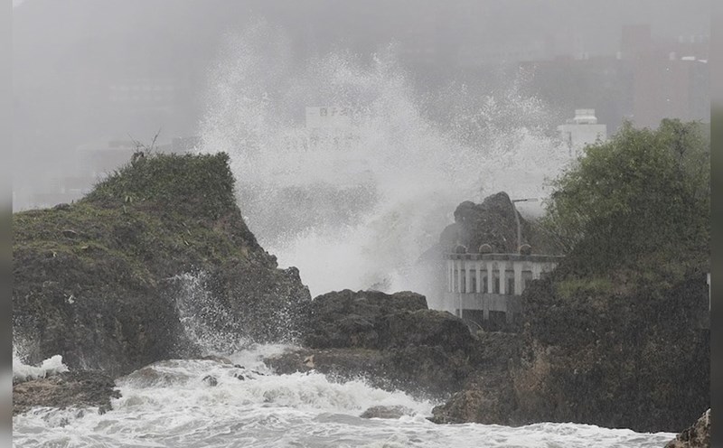
Forecasts show that super typhoon Kong-rey may weaken slightly before making landfall directly on the southeastern coast of Taiwan (China), but will still bring heavy rains, flash floods, storm surges and the risk of landslides.
Experts added that waves could be as high as 8 meters when the typhoon makes landfall with heavy rain across Taiwan (China) on October 31.
Given the complicated developments of super typhoon Kong-rey, residents and tourists planning to visit the Philippines and Taiwan (China) during this time should pay attention to weather forecasts and check flight schedules to proactively plan their itinerary and ensure safety.

