Storm Krathon near the East Sea changes direction, likely to become a super typhoon

Thanh Trà |

Typhoon Krathon is moving northwest over the Philippine Sea east of Cagayan, increasing in strength and the possibility of becoming a super typhoon is not ruled out.

According to the Philippine Atmospheric, Geophysical and Astronomical Services Administration (PAGASA), the center of Typhoon Krathon (local name: Julian) is 235km east of Calayan, Cagayan.

The storm has maximum sustained winds of 120 km/h near the center, gusts of up to 150 km/h and is moving west at 15 km/h.

Du bao huong di cua bao Krathon. Anh: PAGASA
Forecast of the path of Typhoon Krathon. Photo: PAGASA

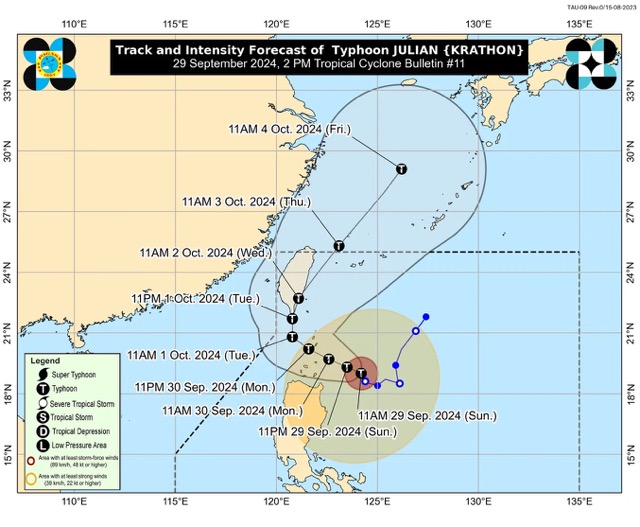
Typhoon Krathon is expected to move mainly west-northwest to northwest from September 29 to the morning of October 1 toward the Batanes-Babuyan Islands area, before accelerating north to north-northeast over waters east of Taiwan (China) from the afternoon of October 1 onwards.

PAGASA said moderate to significant high waves are possible in the coastal areas of Batanes, Cagayan and Ilocos Norte in the next 48 hours. A high wave warning is in effect over the northern and eastern seaboards of Northern Luzon.

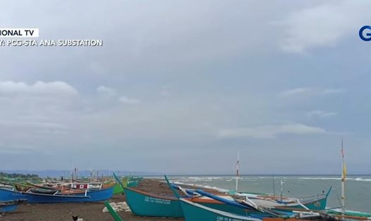
Small boats are warned of the risk of getting into trouble at sea due to the impact of the storm. Some localities in the Philippines have banned boats from going out to sea and residents and tourists from swimming due to the impact of the storm.

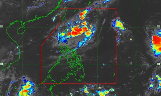
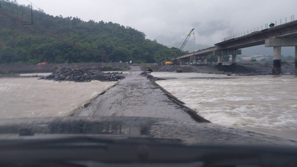
Some areas in the Philippines are experiencing heavy rain and flooding. Local authorities are preparing to evacuate people in areas that may be severely affected.

Co quan Tim kiem va Cuu nan Quirino, Philippines theo doi nuoc dang tren dap tran do anh huong cua bao Krathon. Anh: Mdrrmo Quirino - Quirino Search and Rescue Unit
The Quirino Search and Rescue Unit, Philippines, monitors the rising water on the spillway due to the impact of Typhoon Krathon. Photo: Mdrrmo Quirino - Quirino Search and Rescue Unit

Typhoon Krathon is forecast to make landfall or approach the Philippines on September 30 in Batanes and/or Babuyan Islands as the storm may continue to strengthen over the next 24 to 36 hours.

“With the current intensification trend, the possibility of reaching super typhoon level cannot be ruled out,” PAGASA experts said.

Given these developments, PAGASA recommends that residents and visitors monitor changes and weather updates to proactively adjust activities and travel schedules if necessary.

Thanh Trà
TIN LIÊN QUAN

Bão Julian khả năng thành siêu bão đổ bộ Philippines

Thanh Trà |

Hình thành từ áp thấp nhiệt đới, cơn bão nhiệt đới Julian đã mạnh lên dữ dội vào sáng 29.9 khi di chuyển qua Biển Philippines, gió giật tới 115km/h.

Bão Helene chưa tan, 2 bão mới hình thành

NGUYỄN ĐẠT |

Bão Helene vừa suy yếu thành bão nhiệt đới, 2 cơn bão mới tiếp tục hình thành và hoạt động trên Đại Tây Dương, gây ra những lo ngại mới về thiên tai.

Áp thấp nhiệt đới có thể mạnh lên thành bão cuối tuần này

Thanh Trà |

Áp thấp nhiệt đới “Julian” được dự báo sẽ mạnh lên thành bão nhiệt đới vào 28.9 sau đó, trong khu vực trách nhiệm của Philippines (PAR).

Typhoon Julian likely to become a super typhoon to hit the Philippines

Thanh Trà |

Formed from a tropical depression, tropical storm Julian intensified violently on the morning of September 29 as it moved across the Philippine Sea, with wind gusts of up to 115km/h.

Storm Helene has not dissipated, 2 new storms have formed

NGUYỄN ĐẠT |

Hurricane Helene has just weakened to a tropical storm, two new storms continue to form and operate in the Atlantic, causing new concerns about natural disasters.

Tropical depression could strengthen into storm this weekend

Thanh Trà |

Tropical Depression “Julian” is forecast to intensify into a tropical storm on September 28, within the Philippine Area of ​​Responsibility (PAR).