The US National Hurricane Center (NHC) has just issued warning No. 3 about Potential Tropical Storm No. 5 (AL052024) on August 12, 2024.
The system is moving rapidly westward and is likely to affect Puerto Rico and many islands in the Caribbean.
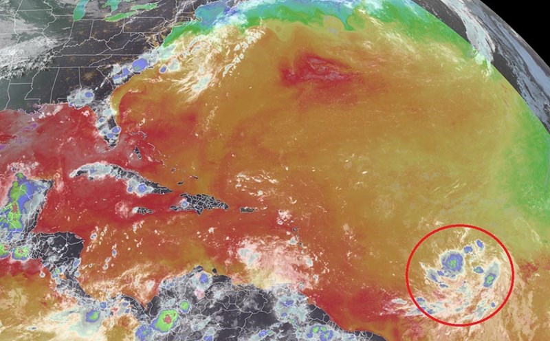
The center of the disturbance is located at 14.4 degrees North latitude; 52.5 degrees West longitude, about 1,040 km southeast of Antigua island and 1,515 km southeast of San Juan, Puerto Rico.
The system is moving westward at 41 km/h, expected to slow in the coming days.
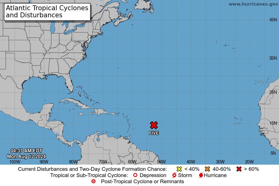
Currently, the wind speed remains at 45 km/h, but is forecast to strengthen in the next few days. There is a high possibility that the system will become a tropical depression by the end of August 12 (local time), and may strengthen into a tropical storm as it approaches the Leeward Islands.
Tropical storm warnings have been issued for many areas. The system is forecast to pass over part of the Leeward Islands tomorrow and approach the Virgin Islands and Puerto Rico later the same evening. When it sweeps through, it will cause heavy rain, waves, gusty winds and high tides.
If this system strengthens into a tropical storm, it will be named Ernesto.
With this dangerous weather situation, tourists need to be cautious and carefully consider their travel plans. If you are in an affected area, follow all evacuation instructions and warnings from local authorities. Prepare an emergency kit and avoid outdoor activities, especially water activities.
Keep in regular contact with relatives and save the address of the host country's embassy. Check and update your travel insurance, making sure it includes coverage for natural disasters.
If you're on an island, learn about safe evacuation locations and how to get there in an emergency.