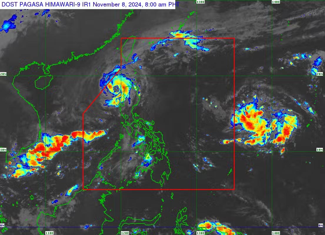
A new low pressure area may enter the Philippine Area of Responsibility (PAR) tonight (November 8) or tomorrow morning (November 9), according to the Philippine Atmospheric, Geophysical and Astronomical Services Administration (PAGASA).
According to PAGASA weather expert Benison Estareja, the cloud clusters over the Pacific Ocean became a low pressure area early on November 8.

“Based on the analysis and movement of this low pressure area, it is likely to enter the Philippine Area of Responsibility (PAR) tonight or tomorrow morning,” he said.
Estareja noted that the low pressure area was last identified 1,975 kilometers southeast of Luzon at 4 a.m. on November 8.
“We still cannot rule out the possibility that this low pressure area will develop into a tropical depression when it enters PAR,” the forecaster said.
This low pressure area is likely to affect most areas of Luzon in the coming days.
Information about the new low pressure area entering PAR was given as Typhoon Yinxing (local name: Marce) made landfall in Northern Luzon.
Although Typhoon Yinxing weakened as it passed over Ilocos Norte early on November 8, the storm was moving at 10 km/h and had maximum sustained winds of 155 km/h and gusts of up to 215 km/h.
Typhoon Yinxing first made landfall in the Philippines at Sta. Ana, Cagayan, at 3:40 p.m. on November 7, before making a second landfall on the northwest coast of Cagayan later that evening.
Typhoon Yinxing has entered the East Sea, becoming the 7th typhoon of the 2024 typhoon season in Vietnam.
According to the National Center for Hydro-Meteorological Forecasting, at 10 p.m. on November 8, the center of the storm was located at about 18.5 degrees North latitude; 116.4 degrees East longitude, in the eastern sea of the North East Sea. The strongest wind near the center of the storm was level 14 (150-166 km/h), gusting to level 17. Moving westward, at a speed of about 15 km/h.
In the North East Sea, strong winds level 8-11, near the storm center level 12-14, gusts level 17, waves 4.0-6.0m high, near the center 7.0-9.0m; rough seas.
Ships operating in the above mentioned dangerous areas are likely to be affected by storms, whirlwinds, strong winds and large waves.


