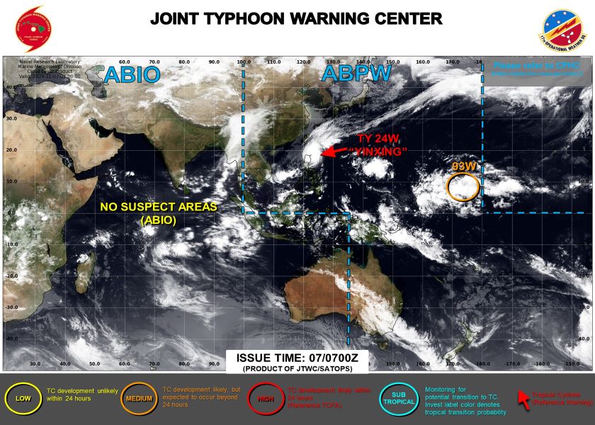
On November 7, the Joint Typhoon Warning Center (JTWC) of the US Air Force and Navy issued warning number 018 on tropical storm Yinxing, active in the Northwest Pacific region.
According to JTWC, at 7:00 p.m. on November 7 (Vietnam time), the center of the storm was located at approximately 18.6 degrees North latitude; 121.5 degrees East longitude, approximately 447 km north of Manila, Philippines. The storm moved at a speed of approximately 16 km/h in the past 6 hours.

The strongest wind at the center of the storm was recorded at about 213.18 km/h, gusting up to 259.48 km/h.
Radius of strong winds of level 6 (118.32 km/h) is about 83.7 km to the northeast; 46.3 km to the southeast; 55.5 km to the southwest and 83.7 km to the northwest.
Meanwhile, the radius of strong winds of level 5 (92.6 km/h) is about 157.4 km to the northeast; 92.6 km to the southeast; 101.9 km to the southwest and 148 km to the northwest.
JTWC forecasts that in the next 12 hours, by 7:00 a.m. on November 8 (Vietnam time), the storm will move westward, with the center of the storm about 139.5 km from the old location, entering a position near 18.6 degrees North latitude; 119.7 degrees East longitude.
The strongest winds near the center decreased to 185.2 km/h, gusting to 231.5 km/h.
In the next 36 hours, until 7:00 a.m. on November 9, the storm will move westward, with the center of the storm about 361.5 km from the old location, entering a position near 18.8 degrees North latitude; 115.8 degrees East longitude.
The strongest wind increased to 194.25 km/h, gusting to 241 km/h.
In the next 48 hours, until 7:00 p.m. on November 9, the storm will continue to move westward, with the center of the storm about 481 km from the old location, entering a position near 19.0 degrees North latitude; 114.7 degrees East longitude.
The strongest wind remained at 194.25 km/h, gusting up to 241 km/h.
After 96 hours, at 7:00 p.m. on November 11, the storm will likely weaken into a tropical depression.
However, the Philippine Atmospheric, Geophysical and Astronomical Services Administration (PAGASA) assessed that it does not rule out the possibility of storm Yinxing strengthening into a super typhoon.
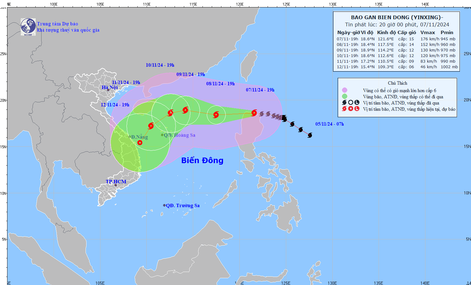
According to the National Center for Hydro-Meteorological Forecasting, as of 7:00 p.m. on November 7, storm Yinxing has significantly strengthened with wind gusts of level 17, is moving west and is expected to enter the East Sea tomorrow (November 8).

Tomorrow, the storm forecast center predicts that the storm will enter the East Sea, causing strong winds of level 14, gusts of level 17, and waves of 6-8m high near the storm center. The northeastern area of the East Sea will be most severely affected.
In the following days, the storm is expected to continue moving in a West-Southwest direction and gradually weaken, but still cause heavy rain and strong winds in the North East Sea area, especially the Hoang Sa archipelago.
The National Center for Hydro-Meteorological Forecasting warns that ships operating in the northeastern waters of the East Sea need to be extremely cautious of strong winds, large waves, and a high risk of encountering storms and violent seas.
Coastal provinces and cities need to proactively take measures to prevent storms and ensure safety for people and property.
For travelers planning to travel to areas likely to be affected by the storm, consider canceling or postponing your trip to ensure safety.
If you are in an area expected to be affected and cannot move, be prepared with adequate food, water, flashlights, radios, personal medications and other necessary items.
It is necessary to regularly update information on weather conditions from official sources and follow the instructions of local authorities to ensure your safety.


