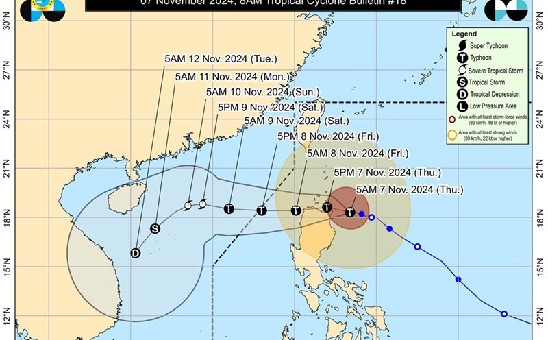
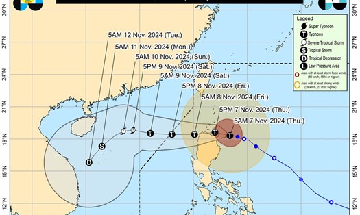
According to the latest weather forecast from the Philippine Atmospheric, Geophysical and Astronomical Services Administration (PAGASA), as of 5 p.m. on November 7 (local time), the center of Typhoon Yinxing was located at approximately 18.5 degrees North latitude - 122.0 degrees East longitude, in the mainland adjacent to Santa Ana, Cagayan. The storm is moving west at a speed of 10 km/h.
The strongest wind near the storm's center remains at 175 km/h, with gusts reaching up to 240 km/h.
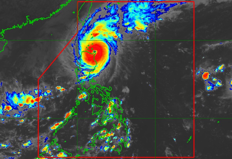
Typhoon Yinxing is forecast to continue moving westward and cross Aparri Bay. The storm may also make another landfall along the northwest coast of mainland Cagayan tonight. Typhoon Yinxing is likely to sweep across the western Philippines early tomorrow morning (November 8).
PAGASA warned that the storm could pose a threat to human life in the next few hours due to strong wind gusts near the eye of the storm. Flooding and heavy rains will occur in the Babuyan Islands and the northern parts of mainland Cagayan, Ilocos Norte and Apayao.
After passing through the northern part of Northern Luzon, Typhoon Yinxing will continue moving westward and exit the Philippine Area of Responsibility (PAR) in the afternoon or evening of November 8.
It is possible that Typhoon Yinxing will reach super typhoon status after passing through northeastern Cagayan, although it will only maintain this intensity for a short time. However, the storm is expected to weaken during the day due to interaction with the terrain of mainland Luzon and dry air from the northeasterly wind flow.
However, Yinxing will remain a typhoon throughout its passage through the PAR region. An increase in northeasterly winds will trigger a period of continued weakening of the storm throughout the weekend.
According to the National Center for Hydro-Meteorological Forecasting, as of 1 p.m. on November 10, the storm was moving west at a speed of about 10 km/h. The center of the storm was located at about 18.9 degrees North latitude - 112.9 degrees East longitude, 300 km north of Hoang Sa archipelago. The strongest wind near the center of the storm was level 11-12, gusting to level 14. The risk level due to natural disasters reached level 3 in the North East Sea area.
Warning: In the next 72 to 120 hours, the storm is likely to change direction to the southwest, moving 10-15km per hour, and continue to weaken. At 1:00 p.m. on November 12 (Vietnam time), the storm will approach the central coast of Vietnam, weakening into a tropical depression before making landfall.
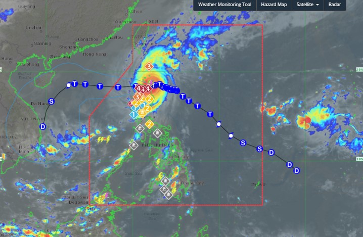
Due to the influence of the storm, the eastern sea area of the North East Sea has strong winds of level 6-7. From the night of November 7, it increased to level 8-11, the area near the storm's center has level 12-14, gusts of level 17, waves 4.0-6.0m high, the area near the center is 6-8m, the sea is very rough.
Due to the unpredictable weather conditions, residents and tourists in areas predicted to be affected by the storm should pay attention to weather forecasts and follow the instructions of local authorities. Passengers should proactively monitor flight schedules and arrange appropriate times to minimize travel disruptions and ensure safety.


