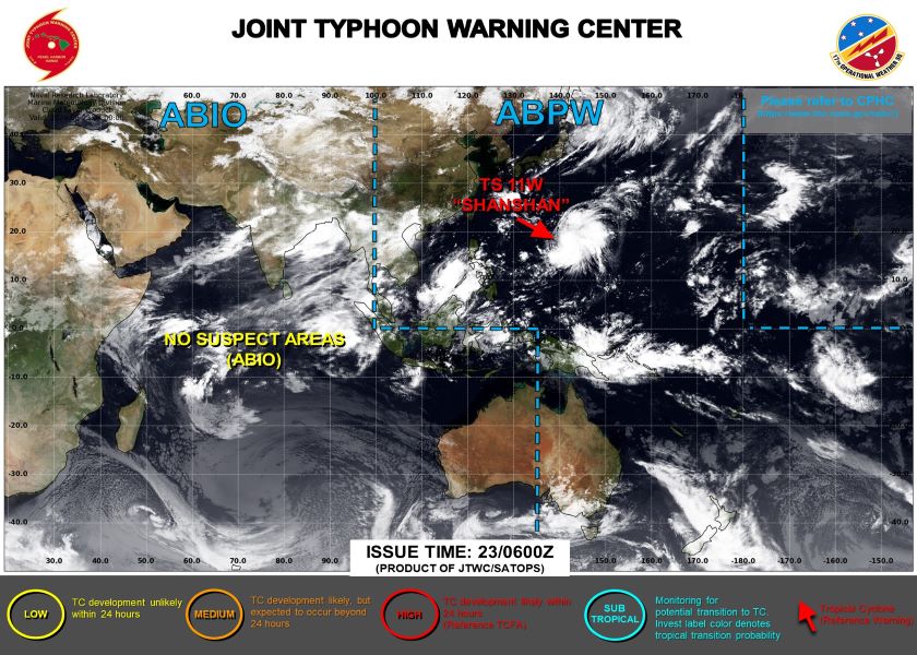
The Joint Typhoon Warning Center (JWTC) has just released an update on tropical storm Shanshan (international number 11W) currently active in the Northwest Pacific Ocean.
According to the latest news, at 6:00 a.m. on August 23 (international time), the center of storm Shanshan was located at about 17.8 degrees North latitude; 141.2 degrees East longitude, about 420 nautical miles south of Japan's Iwo To island. The strongest wind near the center of the storm reaches level 11-12 (111-138km/h), gusting above level 13.
It is forecast that in the next 24 hours, the storm will move in the North Northeast direction at a speed of about 11 knots and is likely to get stronger. By 6 a.m. on August 24, the storm's center is expected to be at about 21.3 degrees North latitude; 140.8 degrees East longitude with the strongest wind remaining at 111-138km/h.
JWTC experts predict that Shanshan will continue to strengthen in the coming days. By August 26, the storm may reach very strong intensity with winds up to 185-212km/h, gusts of over 259km/h.
The meteorological agency warns that the sea near the center of the storm will have strong winds and large waves, with wave heights of up to 8 meters.
Vessels operating in the Pacific Northwest waters need to closely monitor storm developments and take safety measures.
Currently, storm Shanshan has not approached land, but the Japanese government and people are preparing to deal with the upcoming super storm Shanshan.
Storm prevention measures are being strongly implemented, including reinforcing structures, stockpiling food and necessities, as well as planning evacuations for high-risk areas.
Tourists planning to visit Japan in the near future are advised to closely monitor weather information and consider adjusting their schedules to ensure safety. Japanese authorities are also ready to assist tourists in emergencies.
With careful preparation and experience in dealing with natural disasters, Japan is making efforts to minimize possible damage caused by the impact of Typhoon Shanshan.