According to the latest information from the Philippine Atmospheric, Geophysical and Astronomical Services Administration (PAGASA), at 3 a.m. on August 23, the center of storm Shanshan was located at 16.6 degrees North latitude and 141.6 degrees East Canal, about 2,135 km from Central Luzon of this country. The storm carries the strongest winds near the center of up to 100 km/h, with gusts that can reach 125 km/h.
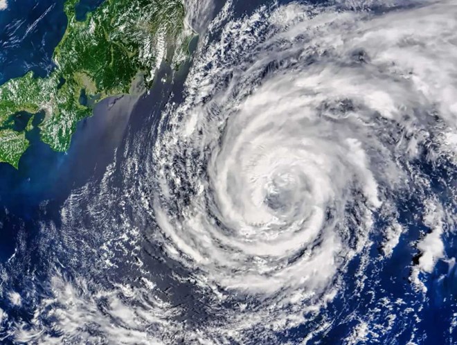
Meteorological experts predict that Shanshan will quickly develop into a super storm in the next 24 hours. The Japan Meteorological Agency (JMA) also made a similar assessment, saying that the storm could reach its maximum intensity on August 23 or August 24.
When it makes landfall in southern Japan, Shanshan is likely to become a level 3 storm on the 5-level Saffir-Simpson storm scale, with central pressure expected to drop to about 980 hPa.
Although the exact time and location of landfall have yet to be determined, areas in southern Japan are expected to be hardest hit.
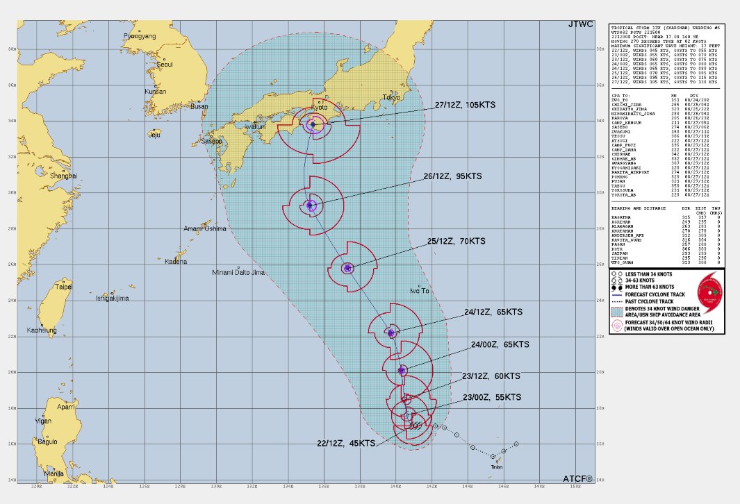
Meteorologist Mike Ventrice shared a map forecasting the path of storm Shanshan on social network X, along with the message "Pray for Japan", expressing concern about the storm's potential devastation. This.
Shanshan appeared just days after Typhoon Ampil swept through Japan, causing much damage and disruption. Typhoon Ampil forced thousands of people to evacuate and canceled hundreds of flights and trains. In Tokyo and surrounding areas, strong winds of up to 209 km/h were recorded in some areas.
Although the impact of Typhoon Ampil on Tokyo was not as severe as initially predicted, it still caused some damage and minor injuries. According to Japanese media reports, about 90,000 tourists were affected by trip cancellations due to the storm.
The Japanese government and people are preparing to deal with the upcoming super storm Shanshan. Storm prevention measures are being strongly implemented, including reinforcing structures, stockpiling food and necessities, as well as planning evacuations for high-risk areas.
Tourists planning to visit Japan in the near future are advised to closely monitor weather information and consider adjusting their schedules to ensure safety. Japanese authorities are also ready to assist tourists in emergencies.
With careful preparation and experience in dealing with natural disasters, Japan is making efforts to minimize possible damage caused by the impact of Typhoon Shanshan.