According to the latest announcement from the US Joint Typhoon Warning Center (JTWC), there is a high possibility that a tropical cyclone will form within the next 12 to 24 hours.
Specifically, at 4:00 p.m. on September 9 (Vietnam time), a tropical depression was detected at 10.6 degrees North latitude; 148.2 degrees East longitude, 498 km from Guam island. This system is named INVEST 95W and is currently moving in a West - Northwest direction at a speed of about 29.6 km/h.
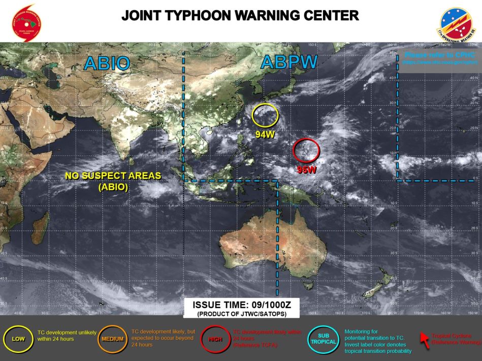
JTWC noted that current environmental conditions are favorable for the development of this system, with warm sea surface temperatures of around 28-29 degrees Celsius, high humidity, weak winds, low to moderate wind shear (VWS) and good outflow at the upper level.
Therefore, JWTC forecast models agree that INVEST 95W will continue to develop rapidly over the next 24 hours as it continues to move northwest.
Forecasts indicate surface winds of 22 - 31 km/h, with an estimated minimum sea level pressure of nearly 1005 mb. The potential for tropical cyclone formation within the next 24 hours is high.
The area at highest risk of impact is identified within a 160 nautical mile radius from 10.6 degrees North latitude and 148.2 degrees East longitude to 14.9 degrees North latitude and 142.9 degrees East longitude.
If the storm forms and strengthens, it is likely to cause negative impacts to the coastal area with large waves and strong winds.
There is currently no warning about the impact of this low pressure area on the mainland, but residents and tourists should absolutely not be subjective, and need to monitor and regularly update news from meteorological centers, to prepare in case the storm forms and has an impact on the area.