The National Center for Hydro-Meteorological Forecasting predicts that tomorrow, September 9, due to the influence of storm No. 3, the Northwest region will continue to have heavy to very heavy rain with common rainfall of 80-150mm, locally over 250mm.
In the Northeast and Thanh Hoa, mountainous and midland areas will have moderate rain, heavy rain, locally very heavy rain and thunderstorms with common rainfall of 40-80mm, locally over 150mm. In the plains, there will be rain, moderate rain, locally heavy rain and thunderstorms with common rainfall of 15-30mm, some places over 60mm.
From September 8-10, people and tourists need to be on guard against floods on rivers in the Northern region and Thanh Hoa. During this flood, the flood peak on small rivers in the northern mountainous provinces, especially Lang Son, Lao Cai, Yen Bai, Hoa Binh, Son La provinces will rise to level 2-3, with some rivers above level 3; the flood peak on Cau River, Thuong River, Buoi River, and the downstream of Ma River (Thanh Hoa) at Ly Nhan Ma will rise to level 1-2 and above level 2.
There is a high risk of flooding in low-lying areas along rivers in the provinces of Lang Son, Lao Cai, Yen Bai, Bac Giang, Thai Nguyen, Hoa Binh, Ninh Binh, Thanh Hoa; flash floods and landslides on steep slopes in mountainous areas of the North and Thanh Hoa.

Hanoi
Lowest temperature: 24-26 degrees Celsius.
Highest temperature: 29-31 degrees Celsius, some places above 31 degrees Celsius.
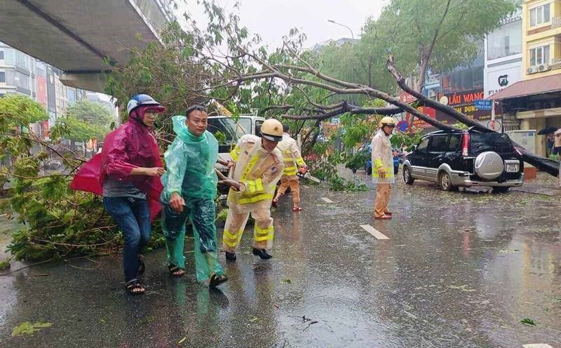
Cloudy, with occasional rain, moderate rain and thunderstorms. East to southeast wind level 2-3. Thunderstorms with possibility of tornadoes, lightning and strong gusts of wind.
Northwest
Lowest temperature: 21-24 degrees Celsius, some places below 21 degrees Celsius.
Highest temperature: 25-28 degrees Celsius, some places above 28 degrees Celsius.
Cloudy with heavy to very heavy rain. Light wind.
Northeast
Lowest temperature: 22-25 degrees Celsius, some places below 22 degrees Celsius.
Highest temperature: 28-31 degrees Celsius, some places in the plains above 31 degrees Celsius.
Cloudy, moderate rain, heavy rain, locally very heavy rain and thunderstorms, especially in the plains and Thanh Hoa, there will be rain, locally moderate rain, heavy rain. East to southeast wind level 2-3. During thunderstorms, there is a possibility of tornadoes, lightning and strong gusts of wind.
Thanh Hoa - Thua Thien Hue
Lowest temperature: 24-27 degrees Celsius.
Highest temperature: 32-35 degrees Celsius, in the South some places are over 35 degrees Celsius.
Cloudy, showers and thunderstorms in the late afternoon and at night, sunny during the day, hot in some places in the South. Southwest wind level 2-3. Thunderstorms are likely to cause tornadoes, lightning and strong gusts of wind.
Da Nang to Binh Thuan
Lowest temperature: 27-30 degrees Celsius.
Highest temperature: 33-36 degrees Celsius, in the North some places are above 36 degrees Celsius.
Cloudy, with showers and thunderstorms in some places in the late afternoon and at night, sunny during the day, especially in the North where it is hot and sunny, with some places experiencing intense heat. Southwest wind level 2-3. There is a possibility of tornadoes, lightning and strong gusts of wind during thunderstorms.
Central Highlands
Lowest temperature: 20-23 degrees Celsius.
Highest temperature: 28-31 degrees Celsius, some places above 31 degrees Celsius.
Cloudy, scattered showers and thunderstorms; scattered showers and thunderstorms in the afternoon and evening, locally heavy rain. Southwest wind level 2-3. Thunderstorms are likely to cause tornadoes, lightning and strong gusts of wind.
Southern Vietnam
Lowest temperature: 24-27 degrees C.
Highest temperature: 31-34 degrees C.
Cloudy, scattered showers and thunderstorms; scattered showers and thunderstorms in the afternoon and evening, locally heavy rain. Southwest wind level 2-3. Thunderstorms are likely to cause tornadoes, lightning and strong gusts of wind.