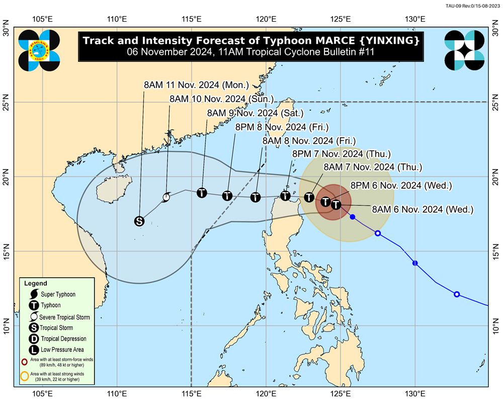
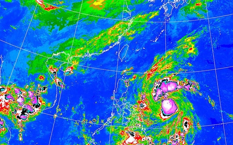
According to the latest weather forecast of the Philippine Atmospheric, Geophysical and Astronomical Services Administration (PAGASA), as of 11:00 a.m. on November 6 (local time), the center of storm Yinxing (local name MARCE) is estimated to be at about 18.1 degrees North latitude - 124.6 degrees East longitude, 305 km east of Tuguegarao City, Cagayan.
The storm is moving west at 10 km/h. The strongest winds near the center of the storm are maintained at 150 km/h, with gusts of up to 185 km/h.
Typhoon Yinxing is forecast to move west-northwest across the eastern Cagayan Sea today (November 6), before gradually accelerating westward tomorrow (November 7). By November 9, Typhoon Yinxing will pass through the Babuyan Channel and the northern part of the West Philippine Sea.

According to the forecast track, Typhoon Yinxing will make landfall and pass through the Babuyan Islands or the northern parts of mainland Cagayan, Ilocos Norte and Apayao (Philippines), or pass very close to these areas from the afternoon of November 7 to the morning of November 8.
The storm may exit the Philippine Area of Responsibility (PAR) by the evening of November 8. Strong northeasterly winds will lead to more southwesterly movement of the storm throughout the weekend.
Typhoon Yinxing is expected to continue to strengthen and may reach its peak intensity today (November 6) as it passes through the Babuyan Channel.
The storm is likely to weaken slightly as it may interact with the terrain of mainland Luzon, although it will remain a typhoon throughout its movement in the PAR. Strong northeasterly winds will cause the storm to weaken steadily throughout the weekend.
Typhoon Yinxing is forecast to enter the East Sea around the evening of August 8, continuing to maintain its strong intensity as a typhoon. It will then gradually weaken into a strong tropical storm around the morning of August 10.
As it moves deeper into the East Sea, the storm continues to weaken. It is forecast that by 8am on August 11, Storm Yinxing will weaken into a tropical storm as it gets closer to the central coast of our country.
With the current weather conditions, residents and tourists who want to travel to the Northern Philippines should pay attention to weather forecasts, monitor flight schedules and check their schedules to avoid being affected by Typhoon Yinxing.


