This year, this year's Atlantic hurricane season could be one of the most active on record, according to the US National Oceanic and Atmospheric Administration (NOAA).
It is expected that the region will see 17-24 storms, including 8 to 13 tropical storms, of which 4-7 could become super typhoons with winds from about 180km/h or more. go up.
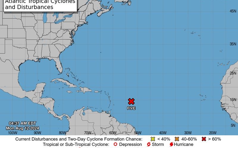
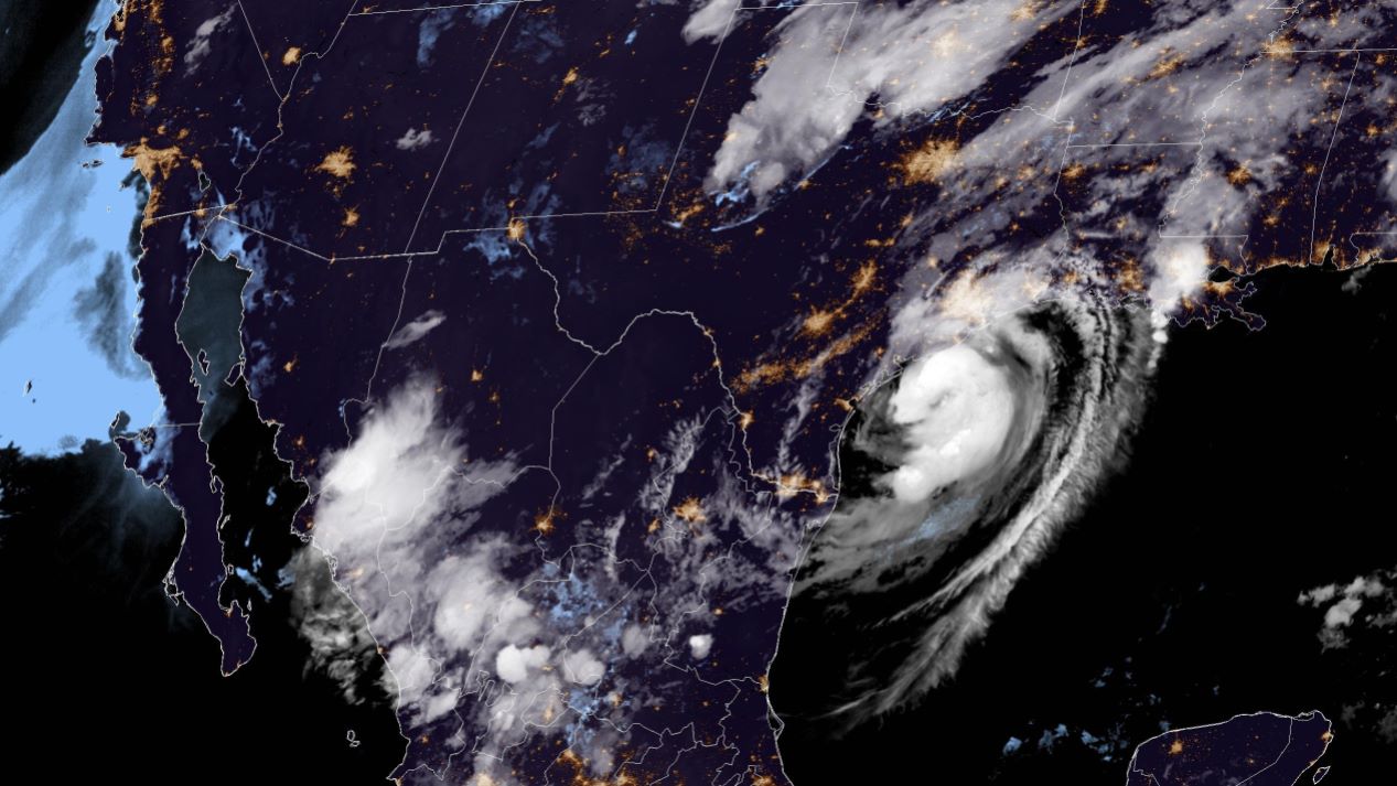
To date, four named storms have appeared in the Atlantic Ocean, including two tropical storms and two hurricanes. Specifically, Hurricane Debby caused a series of recent damages, while Beryl became the first storm to reach level 5.
Mr. Rick Spinrad, Administrator of the US National Oceanic and Atmospheric Administration (NOAA), said: "This year's Atlantic hurricane season is reaching its peak and could cause the most serious damage."
According to NOAA forecasts, the 2024 hurricane season will have a "more than normal" number of storms in the Atlantic region. This is being proven when storms appear earlier and are stronger than every year. Previously, NOAA said the region had only seen a total of 14 named storms, with seven becoming tropical storms.
The cause of this may stem from atmospheric and oceanic conditions, including warmer-than-average sea surface temperatures in the Atlantic and Caribbean Seas, reduced vertical wind shear, and higher winds. Tropical Atlantic trade is weaker and the West African monsoon is stronger.
Scientists believe that the possibility of storms reaching unprecedented intensity is increasing, because in 2023, ocean surface temperatures set a record. Early 2024 records even higher ocean surface temperatures.
Leon Simons, a famous Dutch meteorologist, analyzed: "January 2024 ended with the highest global average ocean surface temperature in observation history. Be ready for more extreme weather in the near future."
Simons predicts that the possibility of a super storm occurring in 2024 cannot be ruled out, when rising sea temperatures under the Atlantic Ocean could affect storm activity. This happened in 2005, when Hurricane Katrina appeared - the fifth hurricane in the 2005 North Atlantic hurricane season. Katrina was the storm that caused the greatest physical damage, and the 5th most human damage. in American history.
It is predicted that the storm season will last until November 30. To ensure trip safety, visitors need to promptly update weather forecast information to have a reasonable and safe travel plan.