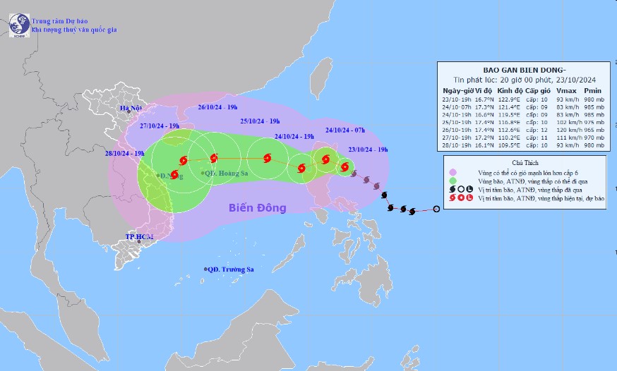
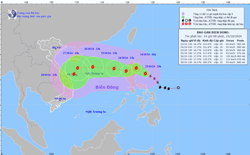
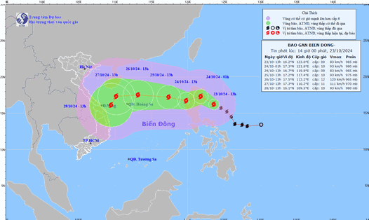
According to the latest weather forecast from the National Center for Hydro-Meteorological Forecasting, at 7:00 p.m. on October 23, the center of the storm was located at approximately 16.7 degrees North latitude - 122.9 degrees East longitude, in the sea east of Luzon Island (Philippines). The strongest wind near the center of the storm is level 9-10 (75-102 km/h), gusting to level 12. The storm is moving in a West-Northwest direction at a speed of 15-20 km/h.
Forecast until 7:00 p.m. on October 24, the storm is moving in the West-Northwest direction, likely to change direction to West-Southwest at a speed of about 15 km/h, entering the East Sea. The storm center is located at 16.6 degrees North latitude - 119.5 degrees East longitude, in the sea area east of the North East Sea. The strongest wind near the storm center is level 9, gusting to level 11. Natural disaster risk level: Level 3, affecting the eastern area of the North East Sea.

At 7:00 p.m. on October 25, the storm moved in a West-Northwest direction, slowing down to a speed of 10-15 km/h. The center of the storm was located at 17.4 degrees North latitude - 116.8 degrees East longitude, in the eastern sea area of the North East Sea, 580 km east of the Hoang Sa archipelago. The strongest wind near the center of the storm was level 10, gusting to level 12. Disaster risk level: Level 3, for the eastern part of the North East Sea area.
At 7:00 p.m. on October 26, the storm moved faster to the West, at a speed of 15-20 km/h. The center of the storm was located at 17.4 degrees North latitude - 112.6 degrees East longitude, in the sea northeast of the Hoang Sa archipelago. The strongest wind near the center of the storm was level 11-12, gusting to level 15. Disaster risk level: Level 3, affecting the North East Sea area.
It is forecasted that in the next 72 to 120 hours, the storm will move mainly in a westerly direction, traveling 10-15km per hour, then it will likely change direction to the South-Southwest and move more slowly.
By 7 p.m. on September 28, storm Tra Mi, with its strongest winds near the storm center at level 10, will approach the offshore area of Da Nang city. The storm is likely to make landfall, although it is uncertain whether the storm will strengthen or weaken as it passes through the East Sea.
Under the influence of the storm, the eastern sea area of the North East Sea has strong winds of level 6-7, near the storm's eye level 8-9 (62-88km/h), gusts of level 11, waves 3.0-5.0m high, near the storm's eye 5.0-7.0m; very rough seas.
In the face of unpredictable weather conditions, residents and visitors in areas forecast to be affected by the storm should pay close attention to weather reports and follow the instructions of local authorities. In particular, heavy rains can cause widespread flooding and natural disasters such as flash floods and landslides in mountainous areas, affecting sightseeing, tourism and outdoor activities.


