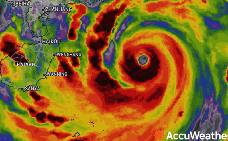
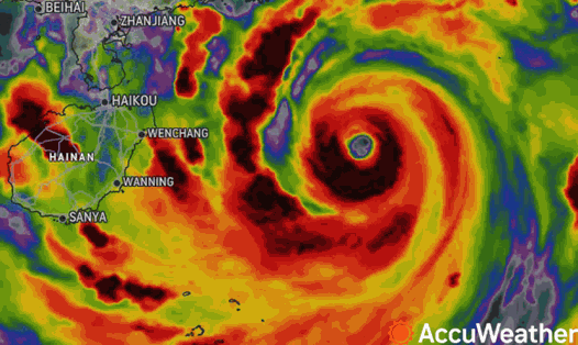
According to the quick news about storm No. 3 issued by the National Center for Hydro-Meteorological Forecasting at 6:00 p.m. on September 7, the center of the storm is located at about 20.9 degrees North latitude; 106.2 degrees East longitude, on the mainland of Quang Ninh - Hai Phong - Hai Duong.
The strongest wind is level 11-12 (103-133km/h), gusting to level 15. It is forecasted that in the next 3 hours, the storm will move west at a speed of about 20km/h.
It is expected that at 4am tomorrow, September 8, the storm will continue to move in the West-Northwest direction at a speed of 15-20km/h and will have completely made landfall in the Northeast, with the center of the storm at 21.0 degrees North latitude and 105.7 degrees East longitude. Wind speed will decrease to level 8, gusting to level 10.
The danger zone includes the area north of latitude 18.5 degrees North and west of longitude 110.0 degrees East. The natural disaster risk level is level 4 for the area north of the Gulf of Tonkin, coastal waters and mainland of Quang Ninh, Hai Phong, Thai Binh provinces; level 3 for the area south of the Gulf of Tonkin, coastal waters and mainland of Nam Dinh, Ninh Binh and Thanh Hoa.
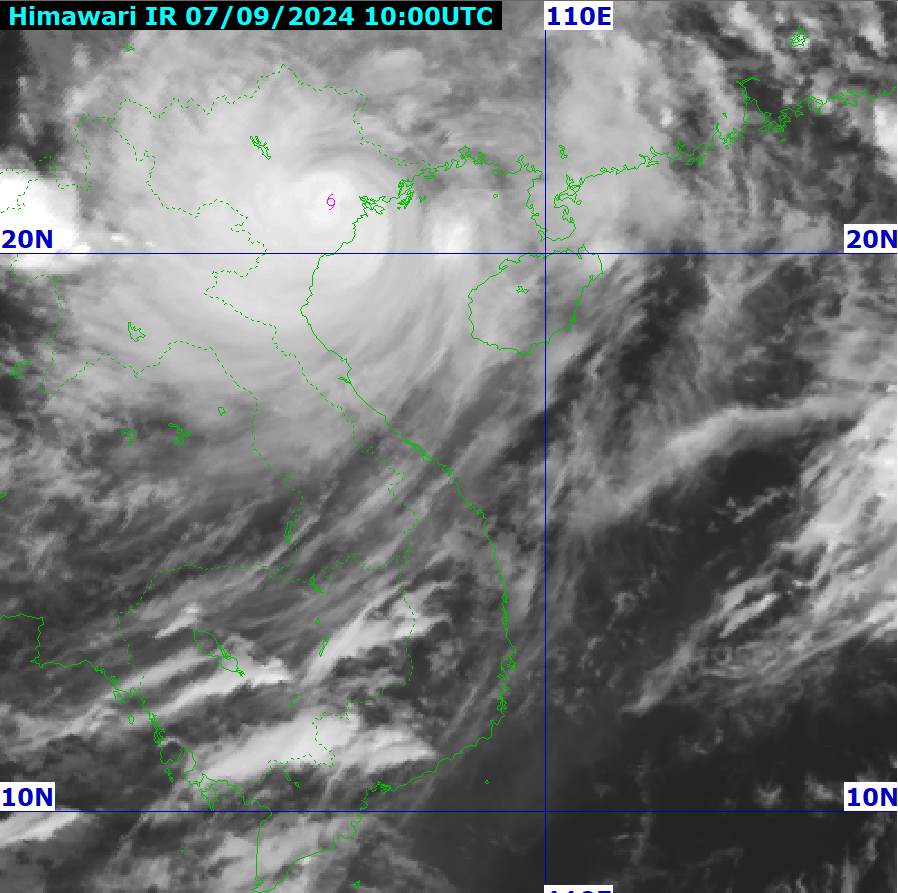
At 4:00 p.m. on September 8, the storm continued to move inland in the West-Northwest direction at a speed of 15-20 km/h and gradually weakened, with the center of the storm at 22.0 degrees North latitude and 102.8 degrees East longitude, on the mainland of the Northwestern provinces of the North.
Wind force has decreased to below level 6. The danger zone has narrowed, concentrated in the area north of latitude 19.5 degrees North and west of longitude 108.5 degrees East. Disaster risk level 3 for the Gulf of Tonkin, coastal waters and mainland provinces of Quang Ninh, Hai Phong, Thai Binh, Nam Dinh, Ninh Binh and Thanh Hoa.

Tomorrow afternoon and night, September 8, the Northeast and Thanh Hoa will have moderate rain, some places will have heavy rain and thunderstorms with common rainfall of 20-50mm, some places will have over 100mm; especially in mountainous areas, there will be heavy rain, some places will have very heavy rain with common rainfall of 60-120mm, locally over 250mm.
The Northwest region from the evening of September 7-9 will have heavy to very heavy rain with common rainfall of 100-350mm, locally over 500mm.
Residents and tourists need to be on guard against heavy rain that can cause flooding in low-lying areas; flash floods in small rivers and streams, and landslides on steep slopes.
Due to the influence of the wide storm circulation, in the Northwest region, the area from Nghe An to Thua Thien Hue needs to be on guard against the risk of thunderstorms, tornadoes, and strong gusts of wind.

Hanoi
Lowest temperature: 23-25 degrees Celsius.
Highest temperature: 27-29 degrees Celsius.
Cloudy, heavy to very heavy rain at night and in the morning; later there will be showers and thunderstorms. At night, strong winds level 6-8, gusting to level 9-11; later the wind will gradually decrease.
Northwest
Lowest temperature: 21-24 degrees Celsius, some places below 21 degrees Celsius.
Highest temperature: 24-27 degrees Celsius, some places above 27 degrees Celsius.
Cloudy, heavy to very heavy rain. At night there will be strong winds of level 4-5, gusting to level 7-8, then gradually decreasing; light winds in the Northwest.
Northeast
Lowest temperature: 23-25 degrees C.
Highest temperature: 27-30 degrees C.
Cloudy, heavy to very heavy rain at night and in the morning; later there will be rain, moderate rain and thunderstorms, locally heavy rain. At night, coastal areas from Quang Ninh to Thanh Hoa will have strong winds of level 7-9, near the storm center level 10-12, gusting to level 14; inland areas in the Northeast, strong winds of level 6-8, gusting to level 9-11; later the wind will gradually decrease.
Thanh Hoa - Thua Thien Hue
Lowest temperature: 24-27 degrees C.
Highest temperature: 32-35 degrees C.
Cloudy, scattered showers and thunderstorms at night, locally heavy to very heavy rain; scattered showers and thunderstorms during the day. Southwest wind level 2-3. Thunderstorms are likely to cause tornadoes, lightning and strong gusts of wind.
Da Nang to Binh Thuan
Lowest temperature: 26-29 degrees Celsius.
Highest temperature: 32-35 degrees Celsius, some places above 35 degrees Celsius.
Cloudy, with scattered showers and thunderstorms in the late afternoon and evening; sunny during the day, with some areas experiencing heat. Southwesterly winds at level 2-3. Thunderstorms are likely to produce tornadoes, lightning, and strong gusts of wind.
Central Highlands
Lowest temperature: 20-23 degrees C.
Highest temperature: 27-30 degrees C.
Cloudy, scattered showers and thunderstorms; scattered showers and thunderstorms in the afternoon and evening, locally heavy rain. Southwest wind level 2-3. Thunderstorms are likely to cause tornadoes, lightning and strong gusts of wind.
Southern Vietnam
Lowest temperature: 24-27 degrees C.
Highest temperature: 31-34 degrees C.
Cloudy, scattered showers and thunderstorms; scattered showers and thunderstorms in the afternoon and evening, locally heavy rain. Southwest wind level 2-3. Thunderstorms are likely to cause tornadoes, lightning and strong gusts of wind.