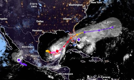
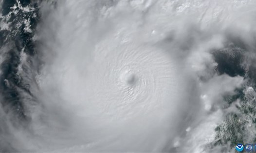
The US National Hurricane Center (NHC) has issued an emergency warning for Hurricane Milton, which is approaching the Florida coast with destructive winds of up to 290 km/h (180 mph) as of 7.10. Although it is weakening as it moves closer to land, it is still one of the strongest storms ever recorded in the Gulf of Mexico.
According to the update at 4:00 a.m. on October 9 (local time), the center of Hurricane Milton is located 255 km west of Dry Tortugas and about 485 km southwest of Tampa, Florida.
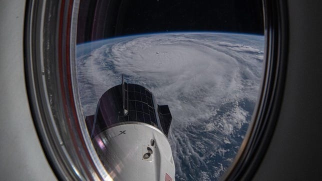
The storm is moving northeast at 14 mph. It will move west to east across Florida. Hurricane Milton will sweep through areas of Florida still devastated by Hurricane Helene.
“This storm was absolutely explosive,” said Bernadette Woods Placky, chief meteorologist at the nonprofit research group Climate Central and co-author of the new report.
The storm is forecast to make landfall on the west-central coast of Florida tonight or early on October 10 (local time). It will then move across the Florida peninsula and out into the Atlantic Ocean by Thursday afternoon.
As Hurricane Milton approaches, the NHC warns of major hazards including storm surge and large waves in the Egmont Key to Boca Grande and Tampa Bay areas of 10 to 15 feet; in addition, many other areas along the Atlantic coast may see large waves in the 5 to 10 feet range.
Rising water combined with high tides will cause severe flooding in coastal areas.
Hurricane Milton could also bring heavy rainfall of 150-300mm, up to 450mm in some places, causing dangerous flooding and flash floods in Central and Northern Florida (USA).
Winds gusting above 73 mph will also affect Florida from the evening of October 9 through the morning of October 10. Gusts could exceed 160 mph near the storm's center.
The NHC also notes that multiple tornadoes could form in Central and South Florida today and tonight.
Due to the extremely complex and dangerous developments of Hurricane Milton, tourists should cancel or postpone all travel plans to Florida and neighboring states in the next few days.
If you are in Florida, follow all evacuation instructions from local authorities. Do not attempt to travel during the hurricane.
Monitor weather updates from official sources and local agencies. Prepare an emergency kit that includes drinking water, non-perishable food, flashlight, battery-powered radio, medications, and important documents.
If you are staying in a hotel, follow staff instructions and be prepared to move to a safe area if necessary. Avoid being outside during a storm. Strong winds can blow out windows, creating dangerous debris.
Do not attempt to drive through flooded roads, as fast-moving water can sweep a car away.
After the storm passes, use caution when traveling as there may be additional hazards such as damaged roads, downed power lines and floodwaters.
Contact your airline or travel agency for information about canceled or rescheduled flights.