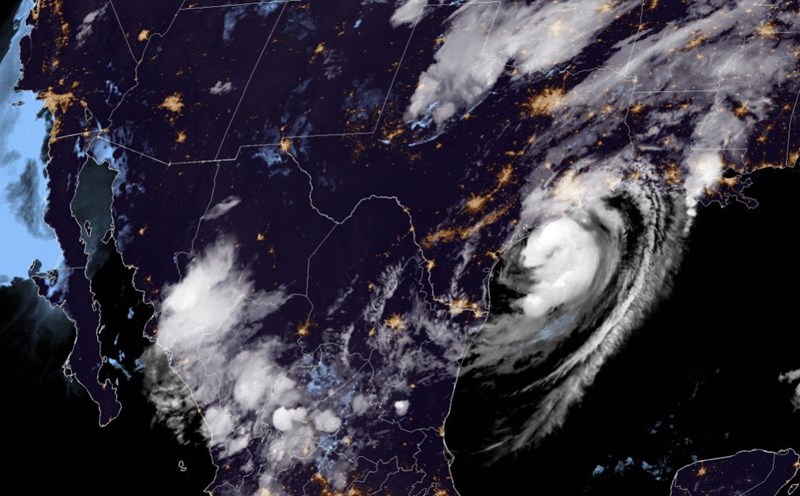
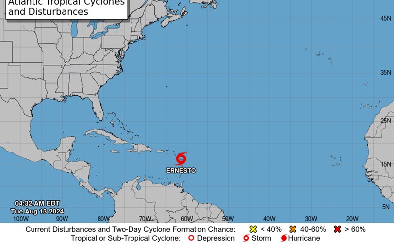
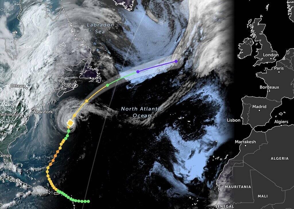
According to the latest announcement from the US National Hurricane Center (NHC) in Miami, storm Ernesto currently has maximum sustained winds of 120 km/h, just reaching the threshold of a level 1 hurricane.
Forecasts show that the storm may continue to strengthen in the next 12 hours, before weakening into a tropical depression on August 20.
Currently, the center of the storm is about 840 km south of Halifax, Nova Scotia province of Canada and is expected to pass near southeastern Newfoundland province late August 19, early August 20 local time.
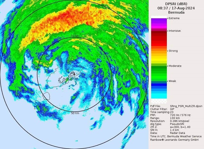
According to the center's warning, storm Ernesto is and will continue to cause large waves affecting many areas, including the Bahamas, Bermuda, the Atlantic coast of Canada and the East Coast of the United States.
The US National Weather Service has warned of the risk of flooding and rising waters on the Atlantic coast until the evening of August 19. In particular, the expert emphasized that large waves "can sweep even the best swimmers away from shore into deeper water".
Given the complicated weather situation, tourists planning to visit the above areas should pay attention to monitoring and updating the latest information about storms from official sources. Consider postponing or changing your itinerary to these areas.
Always follow instructions from local authorities and security personnel. Save contact information for the embassy or consulate in your home country to receive support when needed.
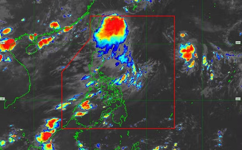
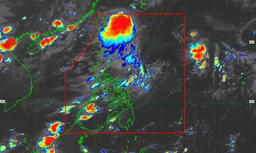
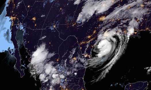
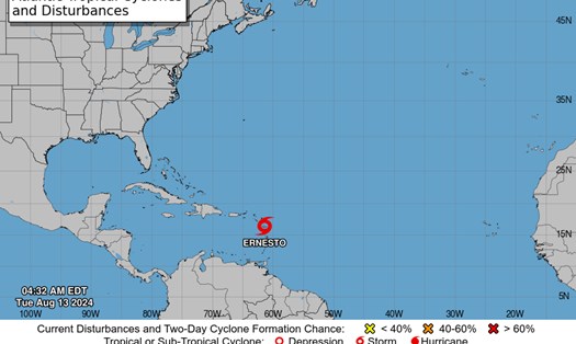
Ernesto is the fifth storm of this year's Atlantic hurricane season, following hurricanes Alberto, Beryl, Cindy and Debby. With complicated weather conditions, tourists need to regularly monitor weather forecasts and pay attention to personal safety when traveling during this storm season.