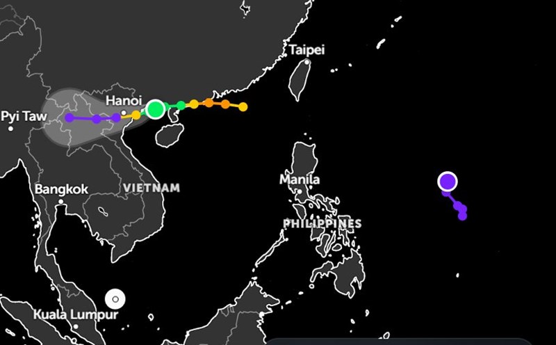
While Typhoon No. 3 Wipha has made landfall in Vietnam, three low pressure areas have appeared near the East Sea and are likely to strengthen into tropical depressions.
According to the Philippine Atmospheric, Geophysical and Astronomical Services Administration (PAGASA), as of 8:00 a.m. on July 22 (local time), the first low pressure (LPA 07h) is moving very close to the East Sea.
The center of this low pressure is located at about 19.8 degrees North latitude - 124.0 degrees East longitude, about 225km East Southeast of Basco Batanes. The low pressure is forecast to strengthen into a tropical depression in the next 24 hours at an average level.
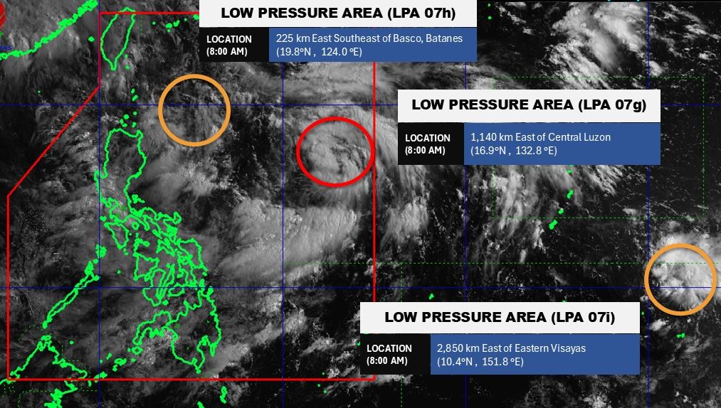
The second low pressure (LPA 07g) has a center at about 16.9 degrees North latitude - 132.8 degrees East longitude, about 1,140km east of the center of Luzon. This low pressure is likely to develop into a tropical depression in the next 24 hours.
The third low pressure (LPA 07i) has a center at about 10.4 degrees North latitude - 151.8 degrees East longitude, about 2,850km east of Eastern Visayas. This low pressure is also likely to develop into a tropical depression in the next 24 hours.
Because it has not yet entered the East Sea, the low pressure has not directly affected the weather in the sea and inland areas of Vietnam. However, the consecutive appearance of low pressure near the East Sea signals a severe storm season in 2025.
According to the National Center for Hydro-Meteorological Forecasting, from July 21 to August 20, the number of storms or tropical depressions in the East Sea is likely to be at a level similar to the average of many years in the same period. Accordingly, the possibility of 2.2 storms or tropical depressions appearing in the East Sea, making landfall in Vietnam is 0.8 and may affect our mainland.
People and tourists planning to travel to the islands in Vietnam and the Philippines in the summer should pay attention to weather forecasts. Proactively check flight schedules and follow instructions from local authorities to ensure safety.