According to the National Center for Hydro-Meteorological Forecasting, at 1:00 p.m. on July 21, the center of the storm was at about 21.1°N; 109.1°E, about 120km from Quang Ninh, 260km from Hai Phong, 280km from Hung Yen and 310km from Ninh Binh to the East Northeast. The strongest wind is level 9-10 (75-102km/h), gusting to level 12. The storm is moving west-southwest at a speed of 10-15km/h.
Due to the impact of storm No. 3, Bach Long Vi Special Zone had strong winds of level 8, gusting to level 9; Co To Special Zone had strong winds of level 6, gusting to level 7.
It is forecasted that by 1:00 a.m. on July 22, the storm will move in a West-Southwest direction at a speed of about 10-15km/h and is likely to strengthen. The center of the storm will then be located in the Northern Gulf of Tonkin, at about 20.7 degrees North latitude - 108.0 degrees East longitude. The storm intensity reached level 10-11, gusting to level 14.
The dangerous area at sea at this time is the area north of the latitude of 18.5 degrees North latitude, from longitude 106.0 to 112.0 degrees East longitude. The affected area includes the northwestern sea area of the North East Sea, the Gulf of Tonkin, and coastal waters of provinces from Quang Ninh to Ninh Binh. The natural disaster risk level is assessed as level 3.
Meanwhile, a new low pressure area has appeared near the East Sea.
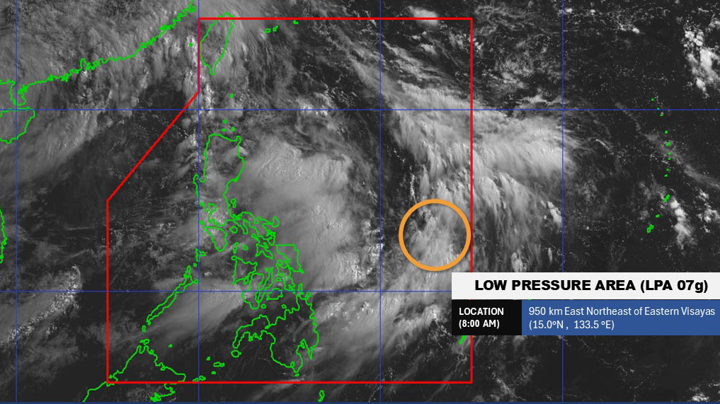
According to the Philippine Atmospheric, Geophysical and Astronomical Services Administration, at 8:00 a.m. on July 21, the center of the low pressure was at about 15.0 degrees North latitude - 133.5 degrees East longitude, about 950km northeast of Eastern Visayas.
The low pressure is moving at a speed of 30km/h and is likely to develop into a tropical depression in the next 24 hours.
Due to the impact of storm No. 3 and the consecutive low pressure appearing near the East Sea, people and tourists should pay attention to weather forecasts. Check flight schedules and follow local instructions to ensure safety.