According to the latest storm news from the Philippine Atmospheric, Geophysical and Astronomical Services Administration (PAGASA), the location of tropical depression Ada was last recorded 545 km east of Hinatuan, Surigao del Sur.
It is forecast that by 2 am on January 15, the tropical depression will be 445 km east of Hinatuan, Surigao del Sur.
The tropical depression is moving in a West-Northwest direction at a speed of 10 km/h. The strongest wind near the center of the tropical depression reaches 45 km/h, gusting up to 55 km/h.
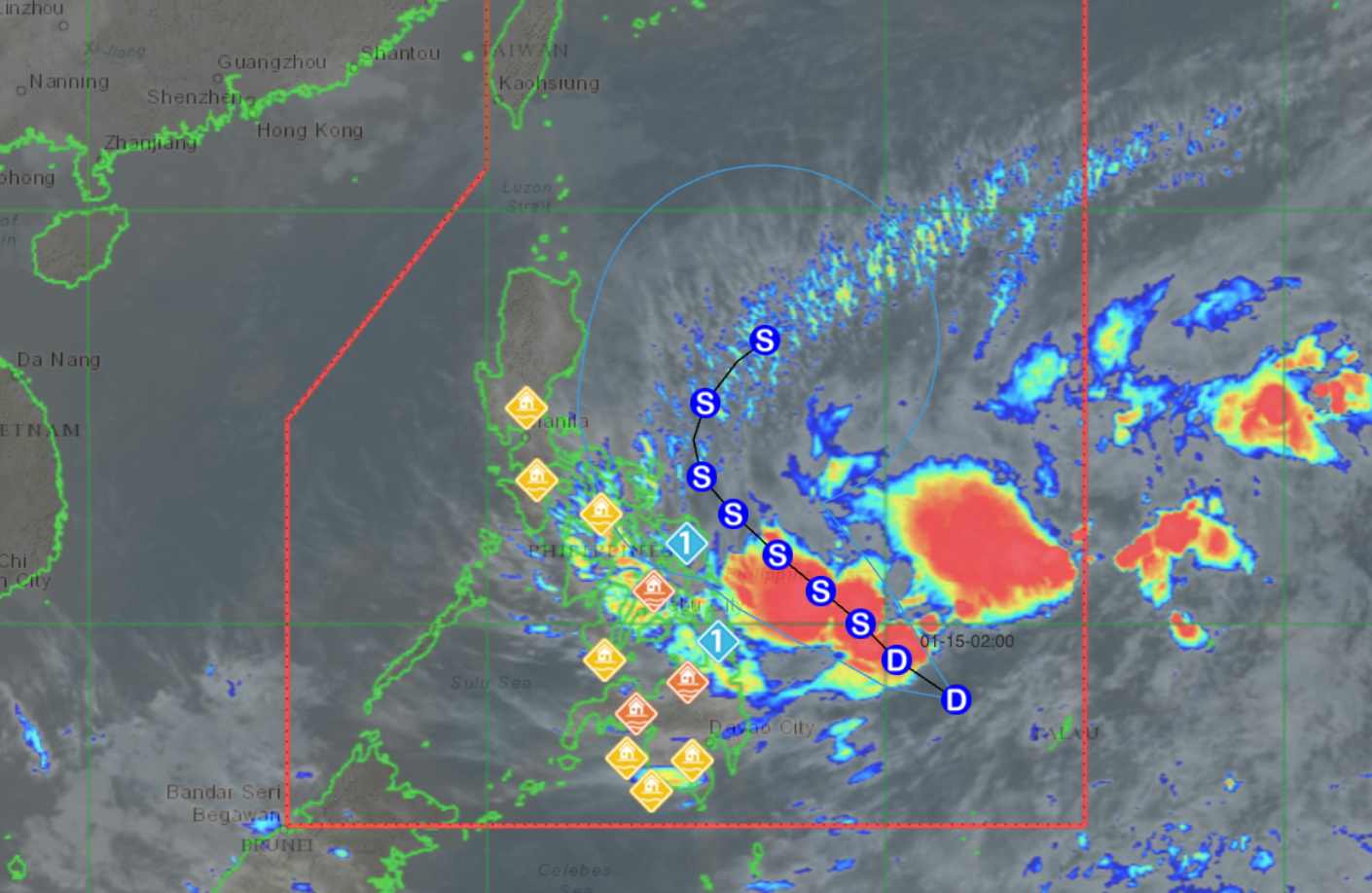
The tropical depression is forecast to strengthen into a storm tomorrow afternoon, January 15. If it strengthens into a storm, this will be the first storm of the 2026 storm season in the Philippines.
PAGASA said 6 areas are in Category 1 storm warning, including North Samar, Samar, East Samar, Dinagat Islands, Surigao del Norte and Surigao del Sur.
The Meteorological Agency forecasts that the northeast monsoon and the periphery of the Ada tropical depression will also carry strong gusts across Batanes, Babuyan Islands, Ilocos Norte, Abra, the northern and eastern continent of Cagayan, eastern Isabela, eastern Bulacan, Aurora, most of Quezon, Camarines Norte, Camarines Sur, Catanduanes and Sorsogon.
The tropical depression is also forecast to cause heavy rain across Eastern Samar, Dinagat Islands, Surigao del Norte and Surigao del Sur. The maximum rainfall may reach 100-200 mm.
After strengthening into a storm tomorrow afternoon, the storm will approach or make landfall in the Eastern Visayas region on Friday (January 16) or Saturday (January 17). Then, the storm will approach or make landfall in Catanduanes on Saturday (January 17) or Sunday (January 18).
People and tourists planning to travel to the Philippines or areas affected by the tropical depression during this time should pay attention to weather forecasts. Check flight schedules and follow local instructions to ensure safety.


