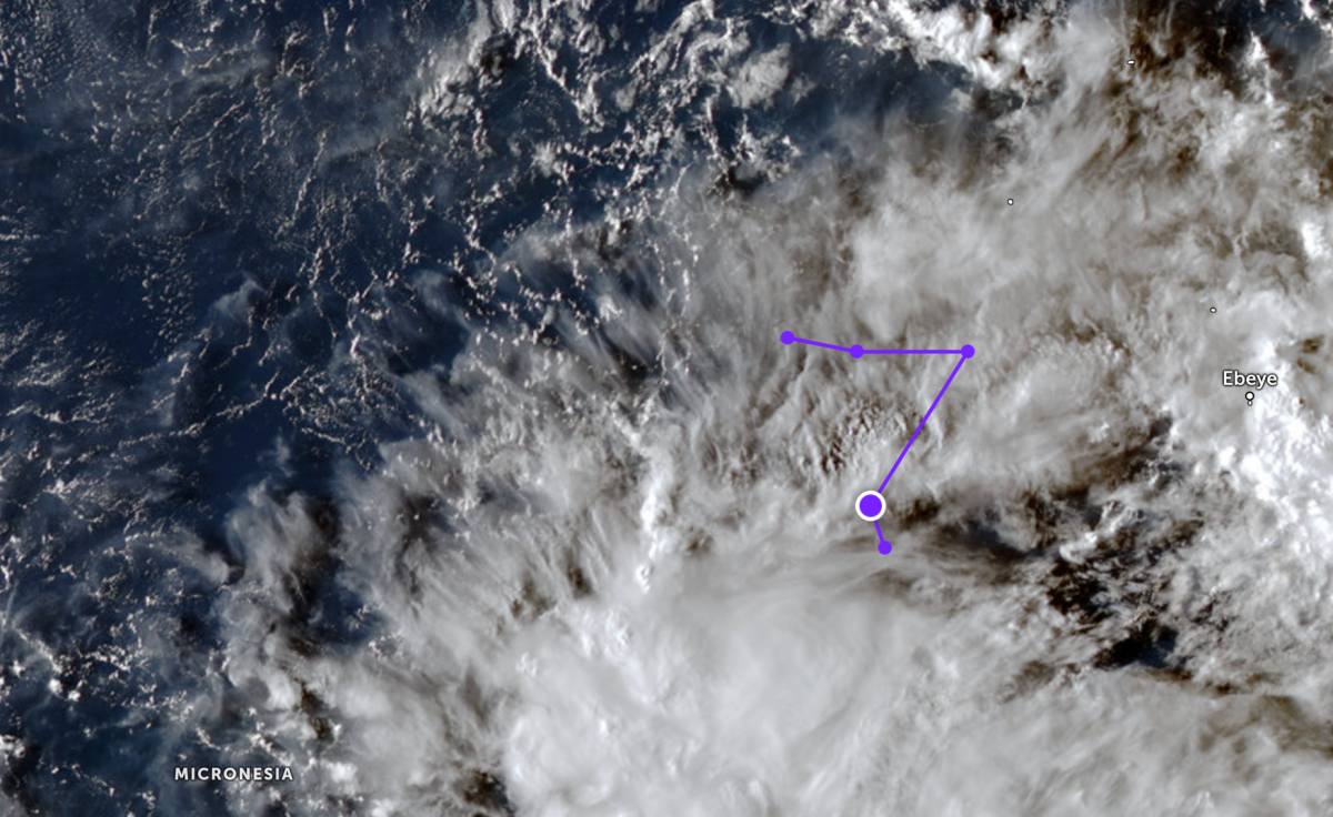
According to storm news, the latest low pressure from the Joint Typhoon Warning Center (JTWC), this morning March 27, a low pressure is operating in the Pacific Ocean.
The center of the low pressure bearing the symbol Invest 99W is located in the western Pacific Ocean, moving in a zigzag motion near the Marshall Islands. The strongest wind near the center of the low pressure reaches 30 km/h.
JTWC forecasts that the low pressure is unlikely to develop strongly into a tropical depression or storm in the next 24 hours.
Meanwhile, Super Typhoon Narelle has approached the mainland in western Australia. The center of Super Typhoon Narelle is currently about 52 km west-southwest of Learmonth (Australia). In the past 6 hours, the super typhoon has moved in a South-Southwest direction at a speed of 26 km/h. The highest wave height reached about 12.2 m.
The storm, which has now been downgraded from level 4 to level 3, is moving through the Northwest Cape area between two famous tourist destinations, Exmouth and Coral Bay, with gusts of up to 250 km/h.
Emergency storm warnings are being issued over a large area along the Pilbara coast, from southern Mardie and Onslow, to Coral Bay, including Barrow and Montebello islands.
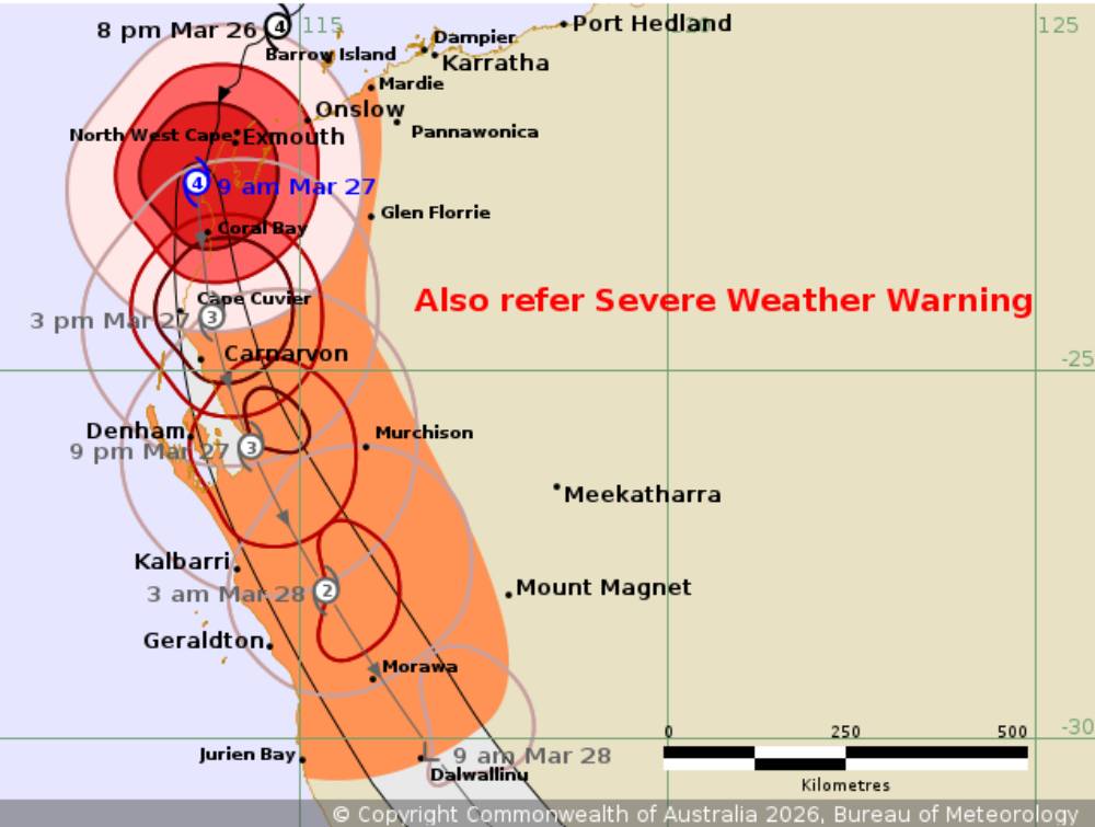
Residents and tourists in the area are advised to shelter indoors as the weather system moves south, the Fire and Rescue Services Department (DFES) warned of direct threats to life and property.
Tourists planning to visit the coastal area of Western Australia, especially places like Exmouth and Coral Bay, need to closely monitor the developments of Hurricane Narelle and proactively adjust their schedules. Authorities recommend limiting travel, staying away from coastal areas and complying with evacuation instructions to ensure safety against the risk of strong winds, big waves and extreme weather.


