According to storm news, the latest low pressure from the Joint Typhoon Warning Center (JTWC), a low pressure is actively operating in the Indian Ocean.
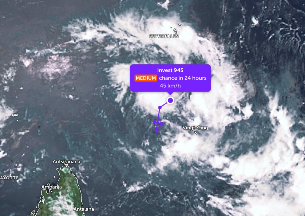
Forecast for this afternoon March 13, low pressure bearing the symbol Invest 94S is located in the South of the Seychelles archipelago.
This system has the potential to develop into a tropical storm in the next 24 hours. In the past 2 days, the low pressure has continuously moved in a circular motion at sea, then heading northeast.
The strongest wind near the center of the low pressure reached 45 km/h. The low pressure is forecast to have a moderate chance of strengthening into a tropical depression in the next 24 hours.
Due to being quite far from the mainland, the low pressure has not affected the weather on the mainland of Seychelles.
In the East Sea, according to the National Center for Hydro-Meteorological Forecasting, in the afternoon of March 13, at Huyen Tran station, strong Northeast wind level 6 was recorded; the sea area northeast of the North East Sea area has Northeast wind level 7.
In the next 24 hours, the continental cold high pressure will continue to strengthen to the East. On the night of March 13 and the day of March 14, the Northern East Sea area (including the Hoang Sa special zone) will have Northeast winds of level 6-7, sometimes level 7, gusts of level 8-9; strong sea waves, waves 3.0-5.0m high.
The sea area from South Quang Tri to Ca Mau and the west of the South East Sea area (including the western Truong Sa special zone) has level 6 Northeast wind, gusts of level 7-8; rough seas, waves 2.0-4.0m high. From March 14, the wind in the northern sea area tends to gradually decrease.
On the night of March 13, the sea area northeast of the Gulf of Tonkin and the Central East Sea area will have level 5 Northeast wind, sometimes level 6, gusting to level 7-8; rough seas, waves 2.0-4.0m high.
Warning on the night of March 14 to March 15, the Northern East Sea area (including Hoang Sa special zone) continues to have strong Northeast winds at level 6, especially the northeast sea area at times level 7, gusts level 8-9; strong sea waves, waves 3.0-5.0m high.
The sea area from Lam Dong to Vinh Long has level 6 Northeast wind, gusts of level 7-8; rough seas, waves 2.0-4.0m high.
People and tourists participating in sea tourism activities, especially in the Central and Southern regions, need to follow the instructions of functional forces, limit swimming or participating in sea activities when the weather is bad to ensure safety.


