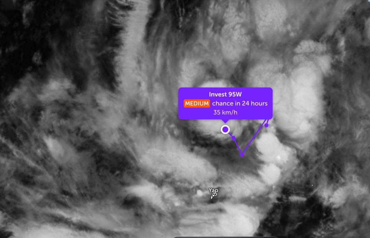
According to storm news, the latest low pressure from the Joint Typhoon Warning Center (JTWC), the low pressure bearing the symbol Invest 95W continues to move towards the East Sea.
As of the afternoon of March 9, the center of the low pressure was about 1,405 km northeast of Mindanao. Previously, the low pressure moved complicatedly when turning from Northeast to Southwest, then continued to move in a Northwest direction, getting closer to the Philippine responsibility area.
The strongest wind near the center of the low pressure reached 35 km/h. The low pressure is forecast to have a moderate chance of strengthening into a tropical depression in the next 24 hours.
Meanwhile, the low pressure bearing the symbol 96W tends to move away from the East Sea. The strongest wind near the low pressure center reaches 35 km/h. This low pressure is unlikely to strengthen into a storm in the next 24 hours.
In the East Sea, according to the National Center for Hydro-Meteorological Forecasting, the North East Sea area currently has strong Northeast wind at level 6, especially the northeast sea area at level 7.
In the next 24 hours, the North East Sea (including the Hoang Sa special zone) will continue to have level 6 Northeast wind, sometimes level 7, gusts level 8-9, strong rough seas, waves 3-0-0 m high. The Gulf of Tonkin at night has level 6 Northeast wind, sometimes level 7, gusts level 8-9, strong rough seas; during the day the wind gradually decreases, waves 2-0-5 m high.
The sea area from Khanh Hoa to Vinh Long and the Southwest of the East Sea (including the western Truong Sa special zone) has Northeast wind level 6, sometimes level 7, gusts level 8-9, strong rough seas, waves high at 2-0-0 m. The area from South Quang Tri to Dak Lak and the South Central East Sea has Northeast wind level 5, sometimes level 6, gusts level 7-8, rough seas, waves high at 2-0-0 m. The North Central East Sea wind gradually strengthens to level 6, gusts level 7-8, waves high at 3-0-0 m.
On the night of March 9 and the day of March 10, the sea area from Da Nang to Khanh Hoa will have scattered showers and thunderstorms, in thunderstorms there is a possibility of tornadoes and strong gusts of wind.
The meteorological agency warned that on the night of March 10, the North East Sea (including the Hoang Sa special zone) will continue to have level 6 Northeast wind, sometimes level 7, gusts level 8-9, strong sea waves, waves 3-0-0 m high. The Central East Sea area has level 5-6 Northeast wind, gusts level 7-8, waves 2-0-4.0 m high and gradually decreases on March 11.
From the night of March 10th to March 11th, the sea area from Dak Lak to Vinh Long and the Southwest of the East Sea (including the western Truong Sa special zone) will have Northeast wind level 6, sometimes level 7, gusts level 8-9, strong rough seas, waves 2.0-4.0 m high.


