According to storm news, the latest low pressure from the Joint Typhoon Warning Center (JTWC), a low pressure near the East Sea has officially strengthened into a storm.
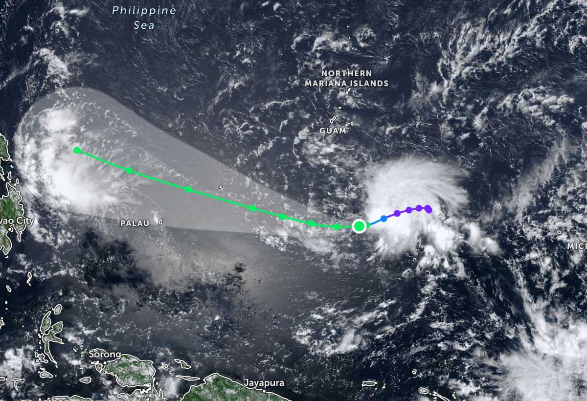
Accordingly, by the morning of May 6, the center of the storm with symbol 05W was located at about 7.3 degrees North latitude - 146.5 degrees East longitude, about 702 km south-southeast of Hagatna.
In the past 6 hours, the storm has moved in a West - Southwest direction at a speed of 20 km/h. The strongest wind near the storm center reached 65 km/h, gusting up to 80 km/h. The maximum wave height reached 4.6 m.
It is forecast that the storm will move mainly westward in the next 36 hours under the continuous impact of the subtropical high pressure located in the northeast. After that, a short wave ridge passing through the North of the system will cause the storm to gradually move west-northwest.
Meanwhile, low pressure 05a is approaching the mainland Philippines. The center of the low pressure is located at about 8.9 degrees North latitude - 129.8 degrees East longitude, about 385 km west of Hinatuan, Surigao del Sur.
The low pressure is unlikely to develop strongly into a tropical depression or storm in the next 24 hours. However, the low pressure also causes rain in the sea and mainland areas around the area.
People and tourists planning to visit these sea areas should pay attention to weather forecasts. Check flight schedules and follow local instructions to avoid storms affecting the journey.


