According to storm news, the latest low pressure from the Philippine Atmospheric, Geophysical and Astronomical Services Administration (PAGASA), two new low pressures have formed near the East Sea.
As of 8 am on May 4 (local time), the center of the low pressure area with symbol 05a is located at 8.0 degrees North latitude - 158.6 degrees East longitude, about 1,350 km east of the Northeast Mindanao region.
The strongest wind near the center of the low pressure reached 30 km/h. The low pressure is unlikely to develop strongly into a storm in the next 24 hours. The low pressure is moving in a West direction, towards the East Sea.
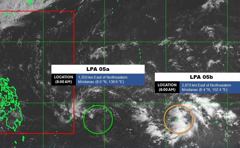
The second low pressure has the symbol 05b, the center position is at about 8.4 degrees North latitude - 152.4 degrees East longitude, about 2,870 km east of the Northeast Mindanao region.
The strongest wind near the low pressure center reaches 30 km/h. The low pressure has a medium possibility of developing strongly into a storm in the next 24 hours.
Because it is still quite far from the mainland, the two low pressures only cause thunderstorms at sea, not greatly affecting the adjacent mainland area.
In the East Sea, according to the National Center for Hydro-Meteorological Forecasting, in the early morning of May 4, there was a strong Northeast wind of level 5 at Bach Long Vi station.
Forecast for the day and night of May 4, the area north of the Gulf of Tonkin has level 4–5 Northeast wind, sometimes level 6 in the morning, gusting level 7; rough seas; waves 1.5–2.5m high.
The Northeast area of the Northern East Sea has Northeast wind level 6, gusts level 7–8; rough seas; waves 2.0–3.0m high.
In addition, the Gulf of Tonkin, the sea area from Ca Mau to An Giang, the Gulf of Thailand and the Central East Sea area have scattered showers and thunderstorms. In thunderstorms, there is a possibility of tornadoes and strong gusts of wind.
People and tourists planning to visit these sea areas should pay attention to weather forecasts. Avoid going out to sea when the sea is rough and follow local instructions to avoid storms and big waves at sea that are dangerous.


